20110520 gis上級技術者会議
Download as KEY, PDF0 likes434 views

The document discusses various geospatial data sources and mapping efforts related to disasters in Haiti, Japan, and other locations. It provides information on imagery data sources like Yahoo ALPS, Bing, and satellite images from JAXA. It describes how satellite imagery from JAXA was used through NIED and contributed to OpenStreetMap after disasters. It also discusses mapping coordination on WikiProject Haiti and lists over 100 mappers who contributed. Ushahidi and Crowdmap platforms are mentioned for collecting reports. The importance of collaboration between various groups and using diverse data sources for crisis mapping and response is a key theme.


20110520 gis上級技術者会議
- 1. GIS 20110520 @mapconcierge http://sinsai.info/ ( )
- 2. b y Ta i c h i
- 3. b y Ta i c h i
- 4. b y Ta i c h i
- 5. Google b y Ta i c h i
- 6. Google X b y Ta i c h i
- 7. b y Ta i c h i
- 8. b y Ta i c h i
- 9. b y Ta i c h i
- 10. OSM OK b y Ta i c h i
- 11. b y Ta i c h i
- 12. b y Ta i c h i
- 13. b y Ta i c h i
- 14. b y Ta i c h i
- 15. by mapconcierge
- 16. b y Ta i c h i
- 17. 2009 b y Ta i c h i
- 18. 2011 b y Ta i c h i 5 7
- 19. 2011 5 7 b y Ta i c h i
- 20. 2011 5 7 b y Ta i c h i
- 21. CC-by-SA by OpenStreetMap 2011 5 7 b y Ta i c h i
- 22. b y Ta i c h i
- 23. b y Ta i c h i
- 24. CC-by-SA by OpenStreetMap 2011 5 7 b y Ta i c h i
- 25. CC-by-SA by OpenStreetMap 2011 5 7 b y Ta i c h i
- 26. CC-by-SA by OpenStreetMap 2011 5 7 b y Ta i c h i
- 27. CC-by-SA by OpenStreetMap 2011 5 7 Bing b y Ta i c h i
- 28. b y Ta i c h i
- 29. b y Ta i c h i
- 30. 2011 5 1 CC-by-SA by Taichi CC-by-SA by Taichi b y Ta i c h i
- 31. 2011 5 1 by UAV CC-by-SA by Taichi b y Ta i c h i
- 32. UAV 5/1 CC-by-SA by Univ.of Tokyo/ISTS/Bizworks/MAPconcierge b y Ta i c h i
- 33. 2011 5 1 CC-by-SA by Univ.of Tokyo/ISTS/Bizworks/MAPconcierge b y Ta i c h i
- 34. 2011 5 1 CC-by-SA by Univ.of Tokyo / ISTS / Bizworks / MAPconcierge b y Ta i c h i
- 35. CC-by-SA by Univ.of Tokyo/ISTS/Bizworks/MAPconcierge 5/1 b y Ta i c h i
- 36. 2011 5 2 CC-by-SA by Kaoru Saito b y Ta i c h i
- 37. 2011 5 1 CC-by-SA by Taichi b y Ta i c h i
- 38. Gigapan 5/1 CC-by-SA by Taichi b y Ta i c h i
- 39. Gigapan 5/1 CC-by-SA by Taichi b y Ta i c h i
- 40. OpenStreetMap since 2004 b y Ta i c h i
- 41. OpenStreetMap Japan since 2008 b y Ta i c h i
- 42. OpenStreetMap Foundation Japan since 2010 b y Ta i c h i
- 43. b y Ta i c h i
- 44. 36 b y Ta i c h i
- 45. b y Ta i c h i
- 46. b y Ta i c h i
- 47. UGC/CGM b y Ta i c h i
- 48. Google Maps/Earth Release in 2005 b y Ta i c h i
- 49. Finding Dr. Jim Gray in 2007 b y Ta i c h i
- 50. Google MyMap since 2007 b y Ta i c h i
- 51. b y Ta i c h i
- 52. 2008 b y Ta i c h i
- 53. h9p://www.cuidemoselvoto.org/ b y Ta i c h i
- 54. h9p://www.cuidemoselvoto.org/ b y Ta i c h i
- 55. DC h9p://snowmageddoncleanup.com/ b y Ta i c h i
- 56. 2010 b y Ta i c h i
- 57. 2010 b y Ta i c h i
- 58. b y Ta i c h i
- 59. 2011 NZ b y Ta i c h i
- 60. 2011 h9p://libyacrisismap.net/ b y Ta i c h i
- 61. 11Mar2011 b y Ta i c h i
- 62. b y Ta i c h i
- 63. Chakuhidi / h9p://hidi.chakuriki.net/ b y Ta i c h i
- 64. radia0on.crowdmap h9p://radiaEon.crowdmap.com/main b y Ta i c h i
- 65. b y Ta i c h i
- 66. 12 Jan 2010 b y Ta i c h i
- 67. b y Ta i c h i
- 68. How? b y Ta i c h i
- 69. b y Ta i c h i
- 70. Wiki b y Ta i c h i
- 71. b y Ta i c h i
- 72. GPS b y Ta i c h i
- 73. b y Ta i c h i
- 74. b y Ta i c h i
- 75. 1/13 "WikiProject Haiti" "The OpenStreetMap community can help the response by tracing Yahoo imagery and other data sources,....." b y Ta i c h i
- 76. b y Ta i c h i F U R U H A S H I
- 77. b y Ta i c h i
- 78. b y Ta i c h i F U R U H A S H I
- 79. Google Maps b y Ta i c h i F U R U H A S H I
- 80. Google Maps b y Ta i c h i F U R U H A S H I
- 81. b y Ta i c h i F U R U H A S H I
- 82. Google Maps b y Ta i c h i F U R U H A S H I
- 83. OpenStreetMap b y Ta i c h i F U R U H A S H I
- 84. b y Ta i c h i F U R U H A S H I
- 85. b y Ta i c h i F U R U H A S H I
- 89. b y Ta i c h i F U R U H A S H I
- 91. b y Ta i c h i F U R U H A S H I
- 92. JAXA b y Ta i c h i F U R U H A S H I
- 93. WMS b y Ta i c h i F U R U H A S H I
- 94. b y Ta i c h i F U R U H A S H I
- 95. OSM b y Ta i c h i F U R U H A S H I
- 96. OSM b y Ta i c h i F U R U H A S H I
- 97. b y Ta i c h i F U R U H A S H I
- 98. OSM b y Ta i c h i F U R U H A S H I
- 99. iPhone b y Ta i c h i F U R U H A S H I
- 100. OpenStreetMap b y Ta i c h i F U R U H A S H I
- 101. 100 ... Mikel Claudius Henrichs Axel von Matern Harry Wood pascal_n Ma9D Tim Waters zvenzzon David Fawce9 Simone Gadenz Dane Springmeyer torsEko MaOa Giovannini Gianfra Phono Nicolas Chavent Dave Smith / DruidSmith Dankarran PB Randal Hale Andrew Turner Phil Shipley tomoki Sam Larsen Christopher Parker EdLoach Robert Sco9 davespod Seehundeführer Esperanza Adam Schreiber Mapconcierge osmapb1 Flacus Imapi ikiya Cohan Bikeman2000 Morten Jagd Christensen ‐ Komяpa Holly Glaser XBear Temporalista acdsig Sergio Sevillano HB9DTX Divebalu Jeffrey Johnson Andrew Allison StellanL Jaakko Helleranta JusEn Houk AssetBurned Andrzej Zaborowski Luc Castera Ceyockey FredB Michael Lane Ævar Arnhörð Bjarmason harrierco Mike Hogan Ivansanchez neuhausr David Runneals ‐ ALE! PaulY Jarno Peschier ‐ Fabianos Osbornec helmed, Kevin KaEe Filbert Boudewijn Julian Thea Clay Fil olvagor Micha Ruh Estela Llorente Gubaer SK53 Kam UbuntuAcer Jonas Krückel (John07) Marc Schneider RatZillaS Colin Marquardt Rafa GuEerrez Jean‐Guilhem Cailton Floris Looijesteijn Samusz clara AndyGates Sean Benne9 steve8 Jean‐Marc LioEer Jarra9p Gert Gremmen (cetest) Xapitoun Lübeck Pierre Beland sxpert http://wiki.openstreetmap.org/wiki/WikiProject_Haiti/Who_is_helping b y Ta i c h i F U R U H A S H I
- 102. 600 b y Ta i c h i F U R U H A S H I
- 103. b y Ta i c h i F U R U H A S H I
- 104. b y Ta i c h i F U R U H A S H I
- 105. 欠 b y Ta i c h i F U R U H A S H I
- 106. 人 b y Ta i c h i F U R U H A S H I
- 107. b y Ta i c h i F U R U H A S H I
- 108. b y Ta i c h i F U R U H A S H I
- 109. b y Ta i c h i
- 110. b y Ta i c h i F U R U H A S H I
- 111. b y Ta i c h i
- 112. b y Ta i c h i
- 113. b y Ta i c h i
- 114. 2 0 1 1 3/19 b y Ta i c h i
- 115. … b y Ta i c h i
- 116. 2 0 1 1 3/11 b y Ta i c h i
- 117. b y Ta i c h i
- 118. 2010 h9p://wiki.openstreetmap.org/wiki/WikiProject_HaiE/Imagery_and_data_sources b y Ta i c h i F U R U H A S H I
- 119. h9p://wiki.openstreetmap.org/wiki/WikiProject_HaiE/Imagery_and_data_sources#JAXA.2FALOS_satellite_Imagery b y Ta i c h i F U R U H A S H I
- 120. h9p://wiki.openstreetmap.org/wiki/WikiProject_HaiE/Imagery_and_data_sources#JAXA.2FALOS_satellite_Imagery b y Ta i c h i F U R U H A S H I
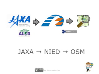
- 121. JAXA → NIED → OSM b y Ta i c h i F U R U H A S H I
- 122. WMS Others ( OSM ) Potlatch JOSM ( OSM ) ( OSM ) b y Ta i c h i F U R U H A S H I
- 123. 2011 ALOS at 18:56 b y Ta i c h i
- 124. b y Ta i c h i
- 125. b y Ta i c h i
- 126. h9p://bosai‐drip.jp/alos/wms.htm b y Ta i c h i
- 127. b y Ta i c h i
- 128. ALOS b y Ta i c h i
- 129. JAXA → NIED with Community → OSM b y Ta i c h i F U R U H A S H I
- 130. h9p://wiki.openstreetmap.org/wiki/JA:2011_Sendai_earthquake_and_tsunami/Mapping_coordinaEon_and_data_sources b y Ta i c h i
- 131. b y Ta i c h i
- 132. by mapconcierge
- 133. h9p://www.sinsai.info/ushahidi/reports/view/19882 by mapconcierge
- 134. b y Ta i c h i
- 135. 1. 2.YahooALPS / 3. / 4.KML 5. / by sinsai.info
- 136. ( ) a. Bing/Yahoo/ / /UAV b. c. POI d. / e. by sinsai.info
- 137. GPS ALPS UAV A lot of Satellite images b y Ta i c h i
- 138. Report Report Report Report API Map Trace Map DonaEon GPS UAV Gigapan b y Ta i c h i A lot of Satellite images
- 139. To g e t h e r f o r t h e E a r t h ! !
Editor's Notes
- #2: \n
- #3: \n
- #4: \n
- #5: \n
- #6: \n
- #7: \n
- #8: \n
- #9: \n
- #10: \n
- #11: \n
- #12: \n
- #13: \n
- #14: \n
- #15: \n
- #16: \n
- #17: \n
- #18: \n
- #19: \n
- #20: \n
- #21: \n
- #22: \n
- #23: \n
- #24: \n
- #25: \n
- #26: \n
- #27: \n
- #28: \n
- #29: \n
- #30: \n
- #31: \n
- #32: \n
- #33: \n
- #34: \n
- #35: \n
- #36: \n
- #37: \n
- #38: \n
- #39: \n
- #40: \n
- #41: \n
- #42: \n
- #43: \n
- #44: \n
- #45: \n
- #46: \n
- #47: \n
- #48: \n
- #49: \n
- #50: \n
- #51: \n
- #52: \n
- #53: \n
- #54: \n
- #55: \n
- #56: \n
- #57: \n
- #58: \n
- #59: \n
- #60: \n
- #61: \n
- #62: \n
- #63: \n
- #64: \n
- #65: \n
- #66: \n
- #67: \n
- #68: \n
- #69: \n
- #70: \n
- #71: \n
- #72: \n
- #73: \n
- #74: \n
- #75: \n
- #76: \n
- #77: \n
- #78: \n
- #79: \n
- #80: \n
- #81: \n
- #82: \n
- #83: \n
- #84: \n
- #85: \n
- #86: \n
- #87: \n
- #88: \n
- #89: \n
- #90: \n
- #91: \n
- #92: \n
- #93: \n
- #94: \n
- #95: \n
- #96: \n
- #97: \n
- #98: \n
- #99: \n
- #100: \n
- #101: \n
- #102: \n
- #103: \n
- #104: \n
- #105: \n
- #106: \n
- #107: \n
- #108: \n
- #109: \n
- #110: \n
- #111: \n
- #112: \n
- #113: \n
- #114: \n
- #115: \n
- #116: \n
- #117: \n
- #118: \n
- #119: \n
- #120: \n
- #121: \n
- #122: \n
- #123: \n
- #124: \n
- #125: \n
- #126: \n
- #127: \n
- #128: \n
- #129: \n
- #130: \n
- #131: \n
- #132: \n
- #133: \n
- #134: \n
- #135: \n
- #136: \n
- #137: \n
- #138: \n
- #139: \n
- #140: \n