SlideShare a Scribd company logo
3
Most read
7
Most read
20
Most read
Presentation on world
map
Presenting world map at a glance
These are continent wise total 194 countries recognized by united
nations
AFRICA (54)

EUROPE (47)

Total countries
in world

 ASIA (44)
 N. AMERICA (23)
 OCEANIA (14)
[Several terms are in use to describe the region comprising Australia
and the nations of the Pacific Ocean. The term Oceania is usually
preferred, and this is the term in use by the United Nations.]
S. AMERICA (12)
Eurasia

The world map depicts Eurasia, a single landmass and largest
continent on the planet, covering about 52 million km². The
continent 'sits' on the Eurasian tectonic plate.
Eurasia is subdivided by convention into Asia and Europe, separated
from each other by the Caspian Sea, the Ural River, and the Urals.
The Ural mountain range runs from the coast of the Arctic Ocean
southwards through western Russia.
land bridge between the Caribbean Sea and the Pacific Ocean.
Presenting world map at a glance
Africa

Second largest landmass is the continent of Africa with an area of
30.2 million km². Africa as we know it, is actually the visible part of
the African tectonic plate,
the rest of the plate is under water of various oceans and seas
around its landmass. The continent is subdivided by convention into
North(ern) Africa, West(ern) Africa, East(ern) Africa, Central
Africa, and Southern Africa.
The continent is shared by 54 countries.
Presenting world map at a glance
The Americas consisting of North and South America and the islands
of the Caribbean. North and South America are geologically
separate continental masses.

Americas

North America is Earth's third largest landmass with an area of 24.2
million km², separated geographically from mainland Asia by the 85
km wide Bering Strait, but
plate tectonically parts of eastern Russia (eastern Siberia) belong to
the North American plate.
Mainland North America is home to four countries: Canada, The
United states ,Mexico and also Greenland belongs geographically
to North America.
North America is connected to South America by the Isthmus of
panama,
Presenting world map at a glance
South America

Americas
(continued)

is located almost entirely in the Southern Hemisphere, it is bordered in
west by the Humboldt (Peru) Current of the Pacific Ocean
and in east by the Brazil Current of the South Atlantic Ocean. With an
area of 17.8 million km² it is number four in the short list of the largest
continents.
The continent is situated on the South American Plate, which in north
meets the Caribbean Plate in the Caribbean Sea, in west the Nazca plate
in the
South Pacific Ocean, and in east it adjoins the African plate.
Presenting world map at a glance
Australia

Australia is both, a country and a continent, it is the smallest in our
hit list of the largest continents, Australia's landmass measures 7.6
million km²,
therefore it is still smaller than the area of Europe with about 10.2
million km². Australia travels together with the island of New Guinea
on the Australia tectonic plate.
Presenting world map at a glance
,

Antarctica

Antarctica has a land area of 14 million km², making it the world's
fifth-largest continent in area. Somewhere in the middle of this vast,
cold and hostile continent is the South Pole,
the southernmost point on the surface of the Earth and the hub, one
of the two endpoints of Earth's rotation axis. Antarctica has its own
tectonic plate, named the Antarctic plate
Presenting world map at a glance
 Here are the world's largest economies as of 2012 using GDP (PPP)
Gross Domestic Product at Purchasing Power Parity. This method
however uses the U.S. dollar to measure each country's equivalent
goods and services.

Top 5 largest
economies
(2012)

countries

GDP

1. United States

$15.29 trillion

2. China

$11.4 trillion,

3. India

$4.5 trillion,

4. Japan

$4.49 trillion

5. Germany

$3.13 trillion
Province wise
map of
Pakistan
City wise
Pakistan map
Presenting world map at a glance

More Related Content

PPTX
Physical Geography Latin America
PPTX
Russia physical geography
PPSX
Lesson 10: Continents and Countries of the World
PPTX
Interesting facts about continents in the world
PPT
South American Geography
PDF
Welcome To Geography!
PPT
Geography of Australia.ppt
PPT
South America - Intro PPT
Physical Geography Latin America
Russia physical geography
Lesson 10: Continents and Countries of the World
Interesting facts about continents in the world
South American Geography
Welcome To Geography!
Geography of Australia.ppt
South America - Intro PPT

What's hot (20)

PPT
Continents of the world
PPT
What is Geography
PPTX
Presentation on world
PDF
Continents
PPTX
Continents
PPTX
The Seven Continents (ppt presentation)
PPTX
PPTX
World Continents And Oceans
PDF
Continents of the world
PPTX
World geography
PPTX
Geography of Asia
PDF
Central Asia People and Places
PPTX
The Arab World
PPT
Middle east geography ppt
PDF
Earth As A Planet
PPTX
South africa power point
PPT
7 continents facts interesting fun
PPTX
The Earth, Rotation and Revolution
PPTX
OCEANS OF THE WORLD
PPTX
Africa for kids
Continents of the world
What is Geography
Presentation on world
Continents
Continents
The Seven Continents (ppt presentation)
World Continents And Oceans
Continents of the world
World geography
Geography of Asia
Central Asia People and Places
The Arab World
Middle east geography ppt
Earth As A Planet
South africa power point
7 continents facts interesting fun
The Earth, Rotation and Revolution
OCEANS OF THE WORLD
Africa for kids
Ad

Similar to Presenting world map at a glance (20)

PPTX
Continents
PPTX
OCEANS and CONTINENTS-CLASS 6 PART -2.pptx
PDF
arond the world by m waseem noonari
PPTX
Blue Earth Science Continents Presentation.pptx
PPTX
Presentation (12).pptx geography world continents topic of bs level
PPT
World continents and oceans
PDF
Oceans and Continents
PPTX
PowerPoint on the topic continents.
PPTX
continents-of-the-world-powerpoint_ver_14.pptx
PPT
Au g-47-continents-of-the-world-powerpoint ver-10
PPT
The 7 continents in the world - a brief explanation
PPTX
WORLD Continent Presentation for student
PPTX
11 The Seven Continents
PPTX
7 continents
PPT
About World Continents
PPT
Continents
PPT
Iift Gk2 Geography
PPTX
7 continents of the world and the 5 Oceans By Mr.Allah Dad Khan Visiting Prof...
PPTX
Continents and sub continents
Continents
OCEANS and CONTINENTS-CLASS 6 PART -2.pptx
arond the world by m waseem noonari
Blue Earth Science Continents Presentation.pptx
Presentation (12).pptx geography world continents topic of bs level
World continents and oceans
Oceans and Continents
PowerPoint on the topic continents.
continents-of-the-world-powerpoint_ver_14.pptx
Au g-47-continents-of-the-world-powerpoint ver-10
The 7 continents in the world - a brief explanation
WORLD Continent Presentation for student
11 The Seven Continents
7 continents
About World Continents
Continents
Iift Gk2 Geography
7 continents of the world and the 5 Oceans By Mr.Allah Dad Khan Visiting Prof...
Continents and sub continents
Ad

Recently uploaded (20)

PDF
Best Camps to Stay at Kumbh Mela – Booking Tips Inside
PDF
Top 10 Must-Visit Destinations in Rajasthan A Guide to the Best Tour Packages...
PDF
Kosher Holiday Homes in Arizona: The Ideal Family Retreat | Enserene
DOCX
Embarking on a journey from Solapur to Kanyakumari.docx
DOCX
12-Day Arunachal Pradesh – Meghalaya – Darjeeling Itinerary.docx
DOCX
Solid Waste Reduction and Recycling Policy.docx
PDF
Your Ultimate Guide to Kumbh Mela Tent Booking 2027.pdf
PDF
Chardham Yatra Packing List 2026 – Essentials to Carry
PDF
Explore Gujarat with the Best Tour Packages
PDF
Nashik Kumbh Mela Package 2027 – Your Complete Travel Guide
PPTX
Luxury in the Skies: Business Class Flights to Tokyo with FlightsLux
PDF
Where is Kailash Mansarovar in India or China.pdf
PDF
Why Rajasthan Luxury Tour Packages Are Today’s Most Desired Escape.pdf
PDF
Coordination Protocols for Multi-Agent Ecosystems.pdf
PDF
Your Ultimate Guide to Arabian Adventures
DOC
Best Astrologer in Agra .
PPTX
Package Module | Dynamic Packaging Software
PDF
Nainital vs Shimla Ropeway: Which Hill Station Ride Wins Your Heart?
PPTX
Gujarat Tour Packages – Spiritual, Cultural & Scenic Journeys
PPTX
Best Tour and Travel- Travel Tips- Damanjit kaur
Best Camps to Stay at Kumbh Mela – Booking Tips Inside
Top 10 Must-Visit Destinations in Rajasthan A Guide to the Best Tour Packages...
Kosher Holiday Homes in Arizona: The Ideal Family Retreat | Enserene
Embarking on a journey from Solapur to Kanyakumari.docx
12-Day Arunachal Pradesh – Meghalaya – Darjeeling Itinerary.docx
Solid Waste Reduction and Recycling Policy.docx
Your Ultimate Guide to Kumbh Mela Tent Booking 2027.pdf
Chardham Yatra Packing List 2026 – Essentials to Carry
Explore Gujarat with the Best Tour Packages
Nashik Kumbh Mela Package 2027 – Your Complete Travel Guide
Luxury in the Skies: Business Class Flights to Tokyo with FlightsLux
Where is Kailash Mansarovar in India or China.pdf
Why Rajasthan Luxury Tour Packages Are Today’s Most Desired Escape.pdf
Coordination Protocols for Multi-Agent Ecosystems.pdf
Your Ultimate Guide to Arabian Adventures
Best Astrologer in Agra .
Package Module | Dynamic Packaging Software
Nainital vs Shimla Ropeway: Which Hill Station Ride Wins Your Heart?
Gujarat Tour Packages – Spiritual, Cultural & Scenic Journeys
Best Tour and Travel- Travel Tips- Damanjit kaur

Presenting world map at a glance

  • 3. These are continent wise total 194 countries recognized by united nations AFRICA (54) EUROPE (47) Total countries in world  ASIA (44)  N. AMERICA (23)  OCEANIA (14) [Several terms are in use to describe the region comprising Australia and the nations of the Pacific Ocean. The term Oceania is usually preferred, and this is the term in use by the United Nations.] S. AMERICA (12)
  • 4. Eurasia The world map depicts Eurasia, a single landmass and largest continent on the planet, covering about 52 million km². The continent 'sits' on the Eurasian tectonic plate. Eurasia is subdivided by convention into Asia and Europe, separated from each other by the Caspian Sea, the Ural River, and the Urals. The Ural mountain range runs from the coast of the Arctic Ocean southwards through western Russia. land bridge between the Caribbean Sea and the Pacific Ocean.
  • 7. Africa Second largest landmass is the continent of Africa with an area of 30.2 million km². Africa as we know it, is actually the visible part of the African tectonic plate, the rest of the plate is under water of various oceans and seas around its landmass. The continent is subdivided by convention into North(ern) Africa, West(ern) Africa, East(ern) Africa, Central Africa, and Southern Africa. The continent is shared by 54 countries.
  • 9. The Americas consisting of North and South America and the islands of the Caribbean. North and South America are geologically separate continental masses. Americas North America is Earth's third largest landmass with an area of 24.2 million km², separated geographically from mainland Asia by the 85 km wide Bering Strait, but plate tectonically parts of eastern Russia (eastern Siberia) belong to the North American plate. Mainland North America is home to four countries: Canada, The United states ,Mexico and also Greenland belongs geographically to North America. North America is connected to South America by the Isthmus of panama,
  • 11. South America Americas (continued) is located almost entirely in the Southern Hemisphere, it is bordered in west by the Humboldt (Peru) Current of the Pacific Ocean and in east by the Brazil Current of the South Atlantic Ocean. With an area of 17.8 million km² it is number four in the short list of the largest continents. The continent is situated on the South American Plate, which in north meets the Caribbean Plate in the Caribbean Sea, in west the Nazca plate in the South Pacific Ocean, and in east it adjoins the African plate.
  • 13. Australia Australia is both, a country and a continent, it is the smallest in our hit list of the largest continents, Australia's landmass measures 7.6 million km², therefore it is still smaller than the area of Europe with about 10.2 million km². Australia travels together with the island of New Guinea on the Australia tectonic plate.
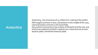
  • 15. , Antarctica Antarctica has a land area of 14 million km², making it the world's fifth-largest continent in area. Somewhere in the middle of this vast, cold and hostile continent is the South Pole, the southernmost point on the surface of the Earth and the hub, one of the two endpoints of Earth's rotation axis. Antarctica has its own tectonic plate, named the Antarctic plate
  • 17.  Here are the world's largest economies as of 2012 using GDP (PPP) Gross Domestic Product at Purchasing Power Parity. This method however uses the U.S. dollar to measure each country's equivalent goods and services. Top 5 largest economies (2012) countries GDP 1. United States $15.29 trillion 2. China $11.4 trillion, 3. India $4.5 trillion, 4. Japan $4.49 trillion 5. Germany $3.13 trillion