SlideShare a Scribd company logo
GDG ON CAMPUS BENHA UNIVERSITY SB
2 0 2 4 / 2 5
From Ground To Structure
A Journey through geomatics, civil and architectural engineering
Objective:
Geomatics Engineering Phase:
What is GIS ?
Data Collection
Land Surveying
Role of Civil Engineering:
Structural Integrity
Material Science
Construction Methods
Influence of Architecture:
Design Functionality
How did the geographic
information journey begin?!
The history of GIS (Geographic Information Systems) dates back
centuries to the time when maps were hand-drawn and primarily
used for exploration, military planning, and trade. As civilizations
progressed, mapping techniques and methods for analyzing
geographic data evolved alongside them.
How did the geographic
information journey begin?!
The industrial revolution and the development of computers
marked a quantum leap in the field of GIS. The advent of
computers made it possible to store and analyze vast amounts of
geographic data with greater accuracy and speed.
The Most Important Milestones
in the Development of GIS
The Nineteenth Century:
Geographic studies began to take on a more scientific approach,
and new methods were developed for collecting and analyzing
geographic data.
Mid-Twentieth Century:
This era witnessed major advancements in computer technology,
which had a profound impact on the development of Geographic
Information Systems.
The Most Important Milestones
in the Development of GIS
Late Twentieth Century:
The first commercial GIS programs emerged, such as ArcGIS, which
became the global standard in the field.
Twenty-First Century:
GIS experienced widespread adoption across various fields, thanks
to significant developments in computer technology and the
Internet.
The Importance of Studying
GIS in Our Current Era
GIS are essential tools in many fields, such as:
Urban Planning: Assessing the environmental impact of urban projects
and designing cities sustainably.
Natural Resource Management: Tracking changes in vegetation cover,
monitoring environmental pollution, and managing protected areas.
Marketing: Analyzing target markets and determining the locations for
new company branches.
Government Administration: Planning infrastructure and delivering
services to citizens.
Environmental Sciences: Studying climate change and its effects on the
environment.
Welcome to
the Structural CAD Course!
Our primary goal is to equip you with the skills
needed to transform architectural drawings into
structural ones effectively and professionally. This is
a critical step in bridging the gap between design
and construction.
Iconic Projects
Burj Khalifa Eiffel Tower
Structural Integrity:
Ensures the building can withstand loads (gravity, wind, earthquakes, etc.)
Designs a safe and stable framework (foundation, beams, columns, etc.)
Material Analysis:
Determines suitable materials for structural elements based on strength
and durability.
Cost Efficiency:
Optimizes structural solutions to reduce costs while maintaining safety.
Risk Management:
Anticipates potential structural risks and provides solutions.
Main skills of a Civil Engineer
SAP2000 is a program used to analyze and design structures,
created by
Computers and Structures Incorporated (CSI). It is one of the
most
popular and powerful tools in civil engineering, and it uses the
Finite Element Method (FEM) for structural analysis.
What is SAP2000?
What is SAP2000?
Structural Analysis: Its the Analysis of different loads such as
live loads, dead loads, earthquakes and wind loads
Design: Design of structural elements such as Coulmns And
beams accrding to various international codes. Verification of
the safety of elements and their optimization to reduce
material usage while ensuring safety.
Structural Modeling: Creation of 3D models for any structure.
Dynamic Analysis: Analysis of the response of structures to
dynamic loads such as earthquakes and vibrations.
SAP2000 Program Functions
Complex Designs: Works on big projects like SkyScrapers
Bridges
Works with Other Tools: Connects with AutoCAD and Revit
Accurate Results: Gives clear and correct outputs
Saves Time and Effort: Speeds up analysis reduces mistakes ,
making projects more efficient.
3D Views: Shows results in 3D
Advantages of SAP2000 Program
Revit is a powerful 3D modeling software that uses BIM
(Building Information Modeling) to help engineers and
architects design, analyze, and document building projects in
one platform.
What is Revit ?
What is Revit ?
Model Structures in 3D
Design beams, columns, foundations, and walls with accuracy.
Work Together Easily
Combine designs with architects and MEP engineers to avoid
clashes.
Save Time
Automatically generate structural plans, sections, and
quantities.
Analyze Data
Prepare models for load and stress analysis.
Visualize Your Ideas
See the entire structure in 3D before it’s built
Revit & Structural Engineering
Understand Real-Life Projects: Practice modeling
structures as done in the industry.
Prepare for Your Career: Gain skills that are in high
demand.
Work Smarter: Impress with professional, well-
documented academic projects.
Collaborate: Learn how to work on multidisciplinary
designs effectively.
Why Should We Learn Revit?
What About
Architectural Phase?
Architectural Design
Project Layout
Field Analysis
Design Ideas
Workingships
Gap Distribution
Front design
General Design
Project Phases
Initiation:
Defining the project's purpose, scope, and objectives.
Planning:
Developing a detailed plan, including timelines, resources, and
budgets.
Execution:
Implementing the project plan and coordinating tasks.
Monitoring and Controlling:
Tracking project progress, identifying issues, and ensuring it
stays on schedule.
Closure:
Finalizing the project, delivering the outcomes, and closing out
documentation
#1 Drawing the Floor Plan:
Creating the horizontal layout of spaces in the building.
#2 Space Distribution:
Organizing and assigning spaces within the layout.
#3 Creating 3D Models:
Generating 3D representations of the building to visualize the
design.
Stages of Using Revit
#4 Placing Doors and Windows:
Inserting doors and windows in the model for accurate architectural
representation.
#5 Exporting from Revit to Other Software:
Converting the Revit model into a format compatible with other programs
for further analysis or presentation.
#6 Importing from Other Software to Revit:
Bringing designs or data from other programs into Revit for integration
and modification.
Stages of Using Revit
Drawing the Floor Plan:
Creating the horizontal layout of spaces in the building using 2D
drafting.
Space Distribution:
Organizing the areas within the floor plan.
Placing Doors and Windows:
Inserting doors and windows into the floor plan for precise detailing.
Exporting from AutoCAD to Other Software:
Converting AutoCAD files into formats compatible with other software
for further use.
Importing from Other Software to AutoCAD:
Bringing designs or data from other programs into AutoCAD for
detailed adjustments.
Usage of AutoCAD
Program-Specific Tools:
Familiarizing with the unique tools in Lumion for creating and
enhancing visualizations.
Rendering Images:
Extracting high-quality images from your 3D models for
presentations and visual outputs.
Creating Videos:
Producing animated walkthroughs or flythroughs by creating
videos of your 3D models to showcase the design.
Stages of Using Lumion
From Ground to Structure: A journey through Construction Fields

More Related Content

PDF
Application Of Building Information Modeling (BIM) To Civil Engineering Projects
PDF
Application of BIM for Scheduling and Costing of Construction Project
PDF
IRJET- Determination of the Efficacy of Civil soft Quick Series in the Desi...
PDF
IRJET - Digital Engineering & Project Management for AEC Industry using BIM
PDF
BIM Ready Topographic Surveys
PDF
BIM for substainable design-white paper
PDF
Application of BIM and Construction Process Simulation using 5D BIM for Resid...
PPTX
revit new phfghhhfghtfghhhdfggffpt 23.pptx
Application Of Building Information Modeling (BIM) To Civil Engineering Projects
Application of BIM for Scheduling and Costing of Construction Project
IRJET- Determination of the Efficacy of Civil soft Quick Series in the Desi...
IRJET - Digital Engineering & Project Management for AEC Industry using BIM
BIM Ready Topographic Surveys
BIM for substainable design-white paper
Application of BIM and Construction Process Simulation using 5D BIM for Resid...
revit new phfghhhfghtfghhhdfggffpt 23.pptx

Similar to From Ground to Structure: A journey through Construction Fields (20)

PDF
IRJET- Digital Engineering & Project Management for AEC Industry using BIM
PDF
Building information modelling report
PPTX
Precision and Progress Navigating the World of Architectural Drafting
PDF
Urbanetic2015_05pdf (1)
PPTX
Building Information Modelling ppt.pptx
PDF
Estimation and Evaluation of G+3 Residential Building
PDF
BIM-Era of digital construction
PDF
Ready to Build the Future? Discover BIM in Architecture
PPTX
Reasons to switch to geographic information system (gis) for civil engineering
PDF
Reimagining Infrastructure | How Native Engineering is Transforming Civil Eng...
PDF
IRJET- 4D Simulation of MEP using Bim for Residential Building Project
PPT
07 It Application01 Intro
PDF
Introduction to BIM
PPTX
Bim and building life cycle
PDF
Bi marabia6en
PDF
Bimarabia6en
PDF
buildinginformationmodeling-161107172241.pdf
PPTX
Point Cloud to BIM Services | Silicon Engineering Consultants New Zealand .pptx
PDF
Hashim Ibnauf Resume
PPTX
Building information modeling
IRJET- Digital Engineering & Project Management for AEC Industry using BIM
Building information modelling report
Precision and Progress Navigating the World of Architectural Drafting
Urbanetic2015_05pdf (1)
Building Information Modelling ppt.pptx
Estimation and Evaluation of G+3 Residential Building
BIM-Era of digital construction
Ready to Build the Future? Discover BIM in Architecture
Reasons to switch to geographic information system (gis) for civil engineering
Reimagining Infrastructure | How Native Engineering is Transforming Civil Eng...
IRJET- 4D Simulation of MEP using Bim for Residential Building Project
07 It Application01 Intro
Introduction to BIM
Bim and building life cycle
Bi marabia6en
Bimarabia6en
buildinginformationmodeling-161107172241.pdf
Point Cloud to BIM Services | Silicon Engineering Consultants New Zealand .pptx
Hashim Ibnauf Resume
Building information modeling
Ad

Recently uploaded (20)

PDF
Unit I ESSENTIAL OF DIGITAL MARKETING.pdf
PDF
Operating System & Kernel Study Guide-1 - converted.pdf
PPTX
bas. eng. economics group 4 presentation 1.pptx
PPTX
Lecture Notes Electrical Wiring System Components
PPTX
UNIT 4 Total Quality Management .pptx
PPTX
Geodesy 1.pptx...............................................
PDF
PRIZ Academy - 9 Windows Thinking Where to Invest Today to Win Tomorrow.pdf
PDF
R24 SURVEYING LAB MANUAL for civil enggi
PPTX
Construction Project Organization Group 2.pptx
PDF
composite construction of structures.pdf
PDF
Well-logging-methods_new................
PDF
Mitigating Risks through Effective Management for Enhancing Organizational Pe...
DOCX
ASol_English-Language-Literature-Set-1-27-02-2023-converted.docx
PPTX
Current and future trends in Computer Vision.pptx
PPT
Project quality management in manufacturing
PDF
Digital Logic Computer Design lecture notes
PPTX
Internet of Things (IOT) - A guide to understanding
PPTX
MET 305 2019 SCHEME MODULE 2 COMPLETE.pptx
PPTX
Infosys Presentation by1.Riyan Bagwan 2.Samadhan Naiknavare 3.Gaurav Shinde 4...
PPTX
Engineering Ethics, Safety and Environment [Autosaved] (1).pptx
Unit I ESSENTIAL OF DIGITAL MARKETING.pdf
Operating System & Kernel Study Guide-1 - converted.pdf
bas. eng. economics group 4 presentation 1.pptx
Lecture Notes Electrical Wiring System Components
UNIT 4 Total Quality Management .pptx
Geodesy 1.pptx...............................................
PRIZ Academy - 9 Windows Thinking Where to Invest Today to Win Tomorrow.pdf
R24 SURVEYING LAB MANUAL for civil enggi
Construction Project Organization Group 2.pptx
composite construction of structures.pdf
Well-logging-methods_new................
Mitigating Risks through Effective Management for Enhancing Organizational Pe...
ASol_English-Language-Literature-Set-1-27-02-2023-converted.docx
Current and future trends in Computer Vision.pptx
Project quality management in manufacturing
Digital Logic Computer Design lecture notes
Internet of Things (IOT) - A guide to understanding
MET 305 2019 SCHEME MODULE 2 COMPLETE.pptx
Infosys Presentation by1.Riyan Bagwan 2.Samadhan Naiknavare 3.Gaurav Shinde 4...
Engineering Ethics, Safety and Environment [Autosaved] (1).pptx
Ad

From Ground to Structure: A journey through Construction Fields

  • 1. GDG ON CAMPUS BENHA UNIVERSITY SB 2 0 2 4 / 2 5
  • 2. From Ground To Structure A Journey through geomatics, civil and architectural engineering
  • 3. Objective: Geomatics Engineering Phase: What is GIS ? Data Collection Land Surveying Role of Civil Engineering: Structural Integrity Material Science Construction Methods Influence of Architecture: Design Functionality
  • 4. How did the geographic information journey begin?! The history of GIS (Geographic Information Systems) dates back centuries to the time when maps were hand-drawn and primarily used for exploration, military planning, and trade. As civilizations progressed, mapping techniques and methods for analyzing geographic data evolved alongside them.
  • 5. How did the geographic information journey begin?! The industrial revolution and the development of computers marked a quantum leap in the field of GIS. The advent of computers made it possible to store and analyze vast amounts of geographic data with greater accuracy and speed.
  • 6. The Most Important Milestones in the Development of GIS The Nineteenth Century: Geographic studies began to take on a more scientific approach, and new methods were developed for collecting and analyzing geographic data. Mid-Twentieth Century: This era witnessed major advancements in computer technology, which had a profound impact on the development of Geographic Information Systems.
  • 7. The Most Important Milestones in the Development of GIS Late Twentieth Century: The first commercial GIS programs emerged, such as ArcGIS, which became the global standard in the field. Twenty-First Century: GIS experienced widespread adoption across various fields, thanks to significant developments in computer technology and the Internet.
  • 8. The Importance of Studying GIS in Our Current Era GIS are essential tools in many fields, such as: Urban Planning: Assessing the environmental impact of urban projects and designing cities sustainably. Natural Resource Management: Tracking changes in vegetation cover, monitoring environmental pollution, and managing protected areas. Marketing: Analyzing target markets and determining the locations for new company branches. Government Administration: Planning infrastructure and delivering services to citizens. Environmental Sciences: Studying climate change and its effects on the environment.
  • 9. Welcome to the Structural CAD Course! Our primary goal is to equip you with the skills needed to transform architectural drawings into structural ones effectively and professionally. This is a critical step in bridging the gap between design and construction.
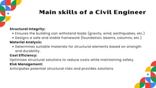
  • 11. Structural Integrity: Ensures the building can withstand loads (gravity, wind, earthquakes, etc.) Designs a safe and stable framework (foundation, beams, columns, etc.) Material Analysis: Determines suitable materials for structural elements based on strength and durability. Cost Efficiency: Optimizes structural solutions to reduce costs while maintaining safety. Risk Management: Anticipates potential structural risks and provides solutions. Main skills of a Civil Engineer
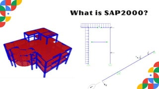
  • 12. SAP2000 is a program used to analyze and design structures, created by Computers and Structures Incorporated (CSI). It is one of the most popular and powerful tools in civil engineering, and it uses the Finite Element Method (FEM) for structural analysis. What is SAP2000?
  • 14. Structural Analysis: Its the Analysis of different loads such as live loads, dead loads, earthquakes and wind loads Design: Design of structural elements such as Coulmns And beams accrding to various international codes. Verification of the safety of elements and their optimization to reduce material usage while ensuring safety. Structural Modeling: Creation of 3D models for any structure. Dynamic Analysis: Analysis of the response of structures to dynamic loads such as earthquakes and vibrations. SAP2000 Program Functions
  • 15. Complex Designs: Works on big projects like SkyScrapers Bridges Works with Other Tools: Connects with AutoCAD and Revit Accurate Results: Gives clear and correct outputs Saves Time and Effort: Speeds up analysis reduces mistakes , making projects more efficient. 3D Views: Shows results in 3D Advantages of SAP2000 Program
  • 16. Revit is a powerful 3D modeling software that uses BIM (Building Information Modeling) to help engineers and architects design, analyze, and document building projects in one platform. What is Revit ?
  • 18. Model Structures in 3D Design beams, columns, foundations, and walls with accuracy. Work Together Easily Combine designs with architects and MEP engineers to avoid clashes. Save Time Automatically generate structural plans, sections, and quantities. Analyze Data Prepare models for load and stress analysis. Visualize Your Ideas See the entire structure in 3D before it’s built Revit & Structural Engineering
  • 19. Understand Real-Life Projects: Practice modeling structures as done in the industry. Prepare for Your Career: Gain skills that are in high demand. Work Smarter: Impress with professional, well- documented academic projects. Collaborate: Learn how to work on multidisciplinary designs effectively. Why Should We Learn Revit?
  • 22. Project Layout Field Analysis Design Ideas Workingships Gap Distribution Front design General Design
  • 23. Project Phases Initiation: Defining the project's purpose, scope, and objectives. Planning: Developing a detailed plan, including timelines, resources, and budgets. Execution: Implementing the project plan and coordinating tasks. Monitoring and Controlling: Tracking project progress, identifying issues, and ensuring it stays on schedule. Closure: Finalizing the project, delivering the outcomes, and closing out documentation
  • 24. #1 Drawing the Floor Plan: Creating the horizontal layout of spaces in the building. #2 Space Distribution: Organizing and assigning spaces within the layout. #3 Creating 3D Models: Generating 3D representations of the building to visualize the design. Stages of Using Revit
  • 25. #4 Placing Doors and Windows: Inserting doors and windows in the model for accurate architectural representation. #5 Exporting from Revit to Other Software: Converting the Revit model into a format compatible with other programs for further analysis or presentation. #6 Importing from Other Software to Revit: Bringing designs or data from other programs into Revit for integration and modification. Stages of Using Revit
  • 26. Drawing the Floor Plan: Creating the horizontal layout of spaces in the building using 2D drafting. Space Distribution: Organizing the areas within the floor plan. Placing Doors and Windows: Inserting doors and windows into the floor plan for precise detailing. Exporting from AutoCAD to Other Software: Converting AutoCAD files into formats compatible with other software for further use. Importing from Other Software to AutoCAD: Bringing designs or data from other programs into AutoCAD for detailed adjustments. Usage of AutoCAD
  • 27. Program-Specific Tools: Familiarizing with the unique tools in Lumion for creating and enhancing visualizations. Rendering Images: Extracting high-quality images from your 3D models for presentations and visual outputs. Creating Videos: Producing animated walkthroughs or flythroughs by creating videos of your 3D models to showcase the design. Stages of Using Lumion