HYBRID IMAGE FUSION

This document discusses hybrid image fusion techniques for combining information from multiple images. It begins by defining image fusion and its applications in remote sensing to produce more informative images. It then describes two main categories of image fusion - spatial domain fusion, which operates directly on pixel values, and frequency domain fusion using transforms like wavelets. The key points are: 1. A hybrid technique is proposed that uses both spatial and frequency domain fusion, taking the sum of each. 2. In frequency domain fusion, discrete wavelet transforms are used to decompose images into approximation and detail coefficients, which are then fused using operations like mean, max, min. 3. The hybrid technique fuses the results of both spatial and frequency domain


![International Research Journal of Engineering and Technology (IRJET) e-ISSN: 2395-0056
Volume: 09 Issue: 08 | Aug 2022 www.irjet.net p-ISSN: 2395-0072
© 2022, IRJET | Impact Factor value: 7.529 | ISO 9001:2008 Certified Journal | Page 1296
Nowadays satellite communication is being advanced at a
higher level using the concept of remote sensing, where the
information of the image is acquired without the physical
contact of the object. In the hybrid fusion technique spatial
and frequency domains are combined for the enhancement
of the image.
3.1 Working of Hybrid Image Fusion
The hybrid image fusion uses the concept of bothspatial and
frequency domain. The algorithm processes two imagesand
fuses both in spatial domain and frequency domain and
takes the sum of products of results of fusion of the first
image and the second image with the given value alpha and
beta respectively.
The algorithm multiplies 0.5 to the fusion values (fusion1
and fusion2) and takes the sum of it to get the final hybrid
fusion value
The algorithm takes the sum of products of fusion1 and
fusion2 with 0.5 to get the final fusion value.
The algorithm takes the sum half of fusion1 and fusion2 to
get the final value of fusion to get the final fusion value.
fusion = alpha * fusion1+ beta * fusion2
Fig -11: Block diagram Hybrid Image Fusion
Fig -12: Fused Output
4. CONCLUSION
By using this method of the Hybrid image fusion we can
achieve the better quality image by the combination of both
spatial and the frequency domain. The resultedimagecan be
used as application for the military and the experimental
purpose.
REFERENCES
[1] TWO STAGE SPATIAL DOMAIN IMAGE FUSION
TECHNIQUES C. Morris and R.S. Rajesh ISSN: 0976-
9102M. Young, The Technical Writer’s Handbook. Mill
Valley, CA: University Science, 1989.
[2] World Academy of Science, EngineeringandTechnology
International Journal of Geological and Environmental
Engineering Vol: 11, No: 9, 2017.
[3] Image Fusion Techniques-A Comparative Study Vibha
Gupta, Sakshi Mehra,International Journal of
Engineering Trends and Technology (IJETT) – Volume
32 Number 2- February 2016.
[4] Image Fusion Based on Wavelet Transformation
Raghawendra Bhimarao Naik, Pavan N.Kunchur
International Journal of Engineering and Advanced
Technology (IJEAT) ISSN: 2249 – 8958 (Online),
Volume-9 Issue-5, June 2020.
[5] Satellite Image Fusion using Fast Discrete Curvelet
Transforms C.V.Rao, J.Malleswara Rao, A.Senthil Kumar,
D.S.Jain, V.K.Dadhwal National Remote Sensing Centre,
Indian Space Research Organization, Hyderabad-
500037, India.
[6] Image Fusion Techniques: A Survey Harpreet Kaur,
Deepika Koundal & Virender Kadyan Archives of
Computational Methods in Engineering Volume 28,
4425–4447 (2021).
[7] A Hybrid Image Fusion Algorithm for Medical
Applications Written by Appari Geetha Devi, Surya
Prasada Rao Borra and Kalapala Vidya Sagar Submitted:
September 30th, 2020 Reviewed: March 2nd, 2021
Published: April 13th, 2021.
3. Hybrid Image Fusion](https://image.slidesharecdn.com/irjet-v9i8213-221028120015-ff2ee278/85/HYBRID-IMAGE-FUSION-4-320.jpg)
HYBRID IMAGE FUSION
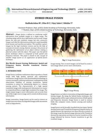
- 1. International Research Journal of Engineering and Technology (IRJET) e-ISSN: 2395-0056 Volume: 09 Issue: 08 | Aug 2022 www.irjet.net p-ISSN: 2395-0072 © 2022, IRJET | Impact Factor value: 7.529 | ISO 9001:2008 Certified Journal | Page 1293 HYBRID IMAGE FUSION Radhakrishna M1, Ullas B C2, Vijay Sakre3, Nikitha T4 1Assistant Professor, Dept. of ECE, Global Academy of Technology, Karnataka, India 2,3,4Student, Dept. of ECE, Global Academy of Technology, Karnataka, India ---------------------------------------------------------------------***--------------------------------------------------------------------- Abstract - Image fusion is defined as combining useful information from multiple images to a single image. The resulting image will be more informative and accurate. Image fusion not only just combines images but also constructs images such that the information produced is understandable from human and machine perception. The satellites capture images by the high resolution camera and by the help of concepts of remote sensing. Remote sensing is the process of gathering the information of an object without making a physical contact with the object. This paper uses the hybrid fusion technique which is composed of both spatial and frequency domains. This paper is based on the concept of satellite image fusion as an application of hybrid fusion technique. Key Words: Remote Sensing, Multisensor, Spatial and Frequency fusion, Wavelet transform, Fourier transform. 1. INTRODUCTION Image fusion combines multisensor data to produce a fused image with high spatial, spectral, and radiometric resolutions. Image fusion isthemostbeneficial technologyin remote sensing for utilizing multisensor,multispectral earth observation satellites at varying resolutions. Spatial resolution is critical for delineating objects in a remote sensing picture. The characteristics of a high spatial resolution image with multispectral information are easier to comprehend than a single high resolution Pan image. The single output image is more informative and accurate than any of the single source image and it consists ofall necessary information Image restoration: Image fusion can be used to restore an image from morethanonedegradedimageswithuncommon areas of degradation. Fig -1: Image Restoration Image mixing: Two or more images can be fused to create a new image which carrier more information. Fig -2: Image Mixing Image fusion can help in restoration of degradedimagesand mixing images. By using the hybrid fusion technique, the image quality will be super enhancedintermsof bothspatial and frequency domains. Image fusion is used in various fields like computer vision, remote sensing and medical imaging. Image fusion can be broadly classifiedintotwotypes:Spatial domain fusion and Transform(Frequency)domainfusion.In spatial domain the operations are done directly on pixels of the image to get the desired image whereasinthe Transform domain the operations are done on Fourier transform of the image followed by Inverse Fourier transform to get the resultant image.
- 2. International Research Journal of Engineering and Technology (IRJET) e-ISSN: 2395-0056 Volume: 09 Issue: 08 | Aug 2022 www.irjet.net p-ISSN: 2395-0072 © 2022, IRJET | Impact Factor value: 7.529 | ISO 9001:2008 Certified Journal | Page 1294 Fig -3: Fusion 1.1 Spatial Image fusion Averaging, Select Maximum / Minimum, and Principal Component Analysis (PCA) are examples of simple image fusion methods. These methods are classified as spatial domain methods. The major drawback of spatial domain approaches is that it produces spatial distortion in fused images and during the further process spectral distortion causes negative impact on image causing classification problems. 1.2IMAGEFUSIONTECHNIQUES(SPATIALDOMAIN) 1.2.1 Simple Average It is a fusion technique that uses pixel averaging to fuse an image. This approach focuses on all parts of the image and works best if the images are captured with the same sort of photographs sensor. It will provide good results if they have a high brightness and contrast. This technique is used in hybrid image fusion for the enhancement of the image. 1.2.2 Minimum Technique It selects the lowest intensity value of the pixelsfromimages and produces fused images. This technique is used in satellite image fusion used in oceanography reflectometry. 1.2.3 Maximum Technique It selects the pixel values of high intensity from images to produce fused images. The high intensity pixel is used to detect the grasslands from the satellite. 1.2.4 Max-Min Technique It selects the averaging values of the pixels smallest and largest from the entire source images and produces the resultant merged image. 2. Frequency Image fusion In frequency image fusion the Fourier transform of the pixel is taken and the value of the pixel is achieved by taking the inverse Fourier transform. 2.1 Wavelet Transform Wavelets can be defined as the wave-like oscillations generated according to the frequency of the pixel values. This transform completely depends on the wavelets of an image. An image after the wavelet transform application is divided into four waveletcoefficients,vertical coefficientand the diagonal coefficient. This procedure keeps onhappening until the desired image is achieved. Fig- 4: Image dividing into wavelet coefficients Both the images are decomposed into wavelet coefficients using Discrete Wavelet Transform. Only single level discrete wavelet decomposition of 4 matrices of coefficients. Fig -5: Four Wavelet Coefficients
- 3. International Research Journal of Engineering and Technology (IRJET) e-ISSN: 2395-0056 Volume: 09 Issue: 08 | Aug 2022 www.irjet.net p-ISSN: 2395-0072 © 2022, IRJET | Impact Factor value: 7.529 | ISO 9001:2008 Certified Journal | Page 1295 Fig -6: Wavelet Coefficients of an image The given above images are the outputs of the wavelet transform .The first image is the approximationimageorthe original image ,the second image is the horizontal component ,the third is the vertical and the fourth is the diagonal component respectively. Fusing all the wavelet coefficients to get the fused wavelets followed bytheinverse discrete wavelet transform results in the fused image. Fig -7: Fusion Process The wavelet coefficients of the two images can be fused using different combinations of mathematical operations. Fusion is performed in two ways 1. fusion1 for approx. coefficient 2. fusion2 for detailed coefficient LL=fusion1 (LL1, LL2) HL=fusion2 (HL1, HL2) LH=fusion2 (LH1, LH2) HH=fusion2 (HH1, HH2) Fusion1 and fusion2 are the mathematical operations such as mean, max and min. Therefore total 9 combinations of mathematical operations on approximation coefficients and detailed coefficients are possible such as MeanMean, MeanMax, MeanMin, MaxMean, MaxMax, MaxMin, MinMean, MinMax, MinMin Table -1: Mathematical operations Based on the data acquisition of a user and by observing the efficiency of the algorithm, a suitable method can be chosen for the appropriate result. Fig -8: MaxMax Fig -9: MinMax Fig -10: MeanMax
- 4. International Research Journal of Engineering and Technology (IRJET) e-ISSN: 2395-0056 Volume: 09 Issue: 08 | Aug 2022 www.irjet.net p-ISSN: 2395-0072 © 2022, IRJET | Impact Factor value: 7.529 | ISO 9001:2008 Certified Journal | Page 1296 Nowadays satellite communication is being advanced at a higher level using the concept of remote sensing, where the information of the image is acquired without the physical contact of the object. In the hybrid fusion technique spatial and frequency domains are combined for the enhancement of the image. 3.1 Working of Hybrid Image Fusion The hybrid image fusion uses the concept of bothspatial and frequency domain. The algorithm processes two imagesand fuses both in spatial domain and frequency domain and takes the sum of products of results of fusion of the first image and the second image with the given value alpha and beta respectively. The algorithm multiplies 0.5 to the fusion values (fusion1 and fusion2) and takes the sum of it to get the final hybrid fusion value The algorithm takes the sum of products of fusion1 and fusion2 with 0.5 to get the final fusion value. The algorithm takes the sum half of fusion1 and fusion2 to get the final value of fusion to get the final fusion value. fusion = alpha * fusion1+ beta * fusion2 Fig -11: Block diagram Hybrid Image Fusion Fig -12: Fused Output 4. CONCLUSION By using this method of the Hybrid image fusion we can achieve the better quality image by the combination of both spatial and the frequency domain. The resultedimagecan be used as application for the military and the experimental purpose. REFERENCES [1] TWO STAGE SPATIAL DOMAIN IMAGE FUSION TECHNIQUES C. Morris and R.S. Rajesh ISSN: 0976- 9102M. Young, The Technical Writer’s Handbook. Mill Valley, CA: University Science, 1989. [2] World Academy of Science, EngineeringandTechnology International Journal of Geological and Environmental Engineering Vol: 11, No: 9, 2017. [3] Image Fusion Techniques-A Comparative Study Vibha Gupta, Sakshi Mehra,International Journal of Engineering Trends and Technology (IJETT) – Volume 32 Number 2- February 2016. [4] Image Fusion Based on Wavelet Transformation Raghawendra Bhimarao Naik, Pavan N.Kunchur International Journal of Engineering and Advanced Technology (IJEAT) ISSN: 2249 – 8958 (Online), Volume-9 Issue-5, June 2020. [5] Satellite Image Fusion using Fast Discrete Curvelet Transforms C.V.Rao, J.Malleswara Rao, A.Senthil Kumar, D.S.Jain, V.K.Dadhwal National Remote Sensing Centre, Indian Space Research Organization, Hyderabad- 500037, India. [6] Image Fusion Techniques: A Survey Harpreet Kaur, Deepika Koundal & Virender Kadyan Archives of Computational Methods in Engineering Volume 28, 4425–4447 (2021). [7] A Hybrid Image Fusion Algorithm for Medical Applications Written by Appari Geetha Devi, Surya Prasada Rao Borra and Kalapala Vidya Sagar Submitted: September 30th, 2020 Reviewed: March 2nd, 2021 Published: April 13th, 2021. 3. Hybrid Image Fusion