Efficient use of Standards-based Interfaces and Encodings in Geospatial Intelligence
Download as PPTX, PDF1 like521 views

The document discusses the efficient use of standards-based interfaces and encodings in geospatial intelligence, focusing on the role of the Open Geospatial Consortium (OGC) in improving global geospatial interoperability. It provides an overview of various OGC standards, such as Web Feature Service (WFS) and Web Map Service (WMS), and their applications, emphasizing the importance of compliance testing and available resources. Additionally, it highlights the development of profiles for defense applications and the certification process for compliant software implementations.


Efficient use of Standards-based Interfaces and Encodings in Geospatial Intelligence
- 2. Efficient use of Standards-based Interfaces and Encodings in Geospatial Intelligence Luis Bermudez PhD, Gobe Hobona PhD 2 Open Geospatial Consortium
- 3. Part 1. Introduction to OGC standards • Fundamentals of interoperability between geospatial technologies • The role of the OGC in improving global geospatial interoperability • What is an OGC Standard? • Overview of OGC Standards • OGC Service Architecture • Overview of freely available standards learning resources 3
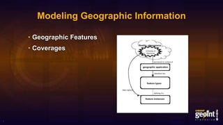
- 4. Modeling Geographic Information • Geographic Features • Coverages 4
- 5. Spatial Referencing • Civic locations using geographic terms or identifiers • Coordinates as numeric values in a coordinate reference system • Linear referencing for linearly located events and linear segments 5
- 6. The role of the OGC in improving global geospatial interoperability • The Havoc of Non-Interoperability • Standards as the basis for the success of the Internet and the World Wide Web 6
- 7. What is an OGC Standard? A document, established by consensus and approved by the OGC Membership, that provides rules and guidelines, aimed at the optimum degree of interoperability in a given context. • Community requirements • Member requirements • Market trends • Technology trends 7
- 8. Overview of OGC Standards • Standards • Abstract Specifications • Best Practices • Engineering Reports • Discussion Papers 8
- 9. Standards • Implementation Standards • Community Standards • Extensions • Profiles 9
- 10. Implementation Standards Overview • Web Feature Service (WFS) • Web Map Service (WMS) • Web Coverage Service (WCS) • Sensor Observation Service (SOS) • Catalogue Service for the Web (CSW) • Web Processing Service (WPS) • OGC CDB • OGC KML • GeoPackage • ...and more! 10
- 11. Web Feature Service (WFS) • Offers direct fine-grained access to geographic information at the feature and feature property level • Suitable for publishing or accessing vector feature data over a network • Example operations: GetFeature, DescribeFeatureType, Transaction 11
- 12. Web Map Service (WMS) • Provides a simple HTTP interface for requesting geo-registered map images from one or more distributed geospatial databases • Suitable for publishing dynamically rendered maps as images • Example operations: GetMap, GetFeatureInfo 12
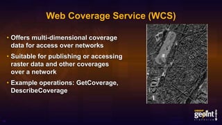
- 13. Web Coverage Service (WCS) • Offers multi-dimensional coverage data for access over networks • Suitable for publishing or accessing raster data and other coverages over a network • Example operations: GetCoverage, DescribeCoverage 13
- 14. Sensor Observation Service (SOS) • Allows querying observations, sensor metadata, as well as representations of observed features • Suitable for publishing or accessing observations made by sensors over a network • Example operations: GetObservation, GetFeatureOfInterest, InsertObservation • Part of the Sensor Web Enablement (SWE) suite 14
- 15. Catalogue Service for the Web (CSW) • Provides the ability to publish and search collections of descriptive information (metadata) for data, services, and related information objects. • Suitable for publishing and accessing metadata (e.g. NMF, ISO 19115 etc) over a network • Example operations: GetRecords, DescribeRecord, Transaction 15
- 16. Web Processing Service (WPS) • Provides rules for standardizing how inputs and outputs (requests and responses) should be passed to geospatial processing services, such as polygon overlay • Suitable for publishing geospatial processes and other types of algorithms • Example operations: Execute, DescribeProcess 16
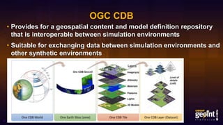
- 17. OGC CDB • Provides for a geospatial content and model definition repository that is interoperable between simulation environments • Suitable for exchanging data between simulation environments and other synthetic environments 17
- 18. OGC KML • An XML language focused on geographic visualization, including annotation of maps and images • Submitted to OGC by Google; used by Google Earth 18
- 19. GeoPackage • An open, standards-based, platform- independent, portable, self- describing, compact format for transferring geospatial information • Suitable for storage of vector features, imagery and raster maps • Stands out in DDIL environments and on low SWaP devices 19
- 20. Profiles • A subset of a standard (selected subset of conformance classes) • Imposes additional constraints on an existing standard • Can also be extended to offer specialized functionality (called profile with extensions) 20
- 21. Abstract Specifications • Provides the conceptual foundation for most OGC specification development activities • Example 1: Topic 11 – Metadata • Example 2: Topic 12 – The OpenGIS Service Architecture 21
- 22. Best Practices • Procedures and approaches that are accepted by the OGC membership as the most effective for addressing a particular need • Example 1: OGC Best Practice for using Web Map Services (WMS) with Ensembles of Forecast Data • Example 2: Gazetteer Service - Application Profile of the Web Feature Service Best Practice 22
- 23. Engineering Reports • Documents that are produced by OGC Innovation Program initiatives as deliverables • Their purpose is to provide the evidence to inform discussion in the geospatial information industry on a specific topic • Examples: Testbed-14 Engineering Reports 23
- 24. Discussion Papers • Documents that present technology issues being considered in the Working Groups of the Open Geospatial Consortium Technical Committee • Their purpose is to create discussion in the geospatial information industry on a specific topic • Example: DGIWG supplied DPs 24
- 26. Part 2. Standards Profiles for Defence • Overview of NSG profiles that have been developed on top of OGC standards • Relationship to DGIWG specifications • Applying the standards and profiles to a GEOINT scenario • Other DGIWG Profiles of OGC standards • Reference Implementations 26
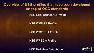
- 27. Overview of NSG profiles that have been developed on top of OGC standards • NSG GeoPackage 1.2 Profile • NSG WMS 1.3 Profile • NSG WMTS 1.0 Profile • NSG WFS 2.0 Profile • NSG Metadata Foundation 27
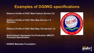
- 28. Examples of DGIWG specifications • Defence Profile of OGC Web Feature Service 2.0 • Defence Profile of OGC Web Map Service 1.3 Revision • Defence Profile of OGC Web Map Tile Service 1.0 • Multinational Geospatial Co-Production (MGCP) Portrayal Specification • DGIWG Metadata Foundation 28
- 29. Relationship between NSG and DGIWG Profiles 29 • NSG WFS 2.0 Profile • NSG WMS 1.3 Profile • NSG WMTS 1.0 Profile • NSG Metadata Foundation • Defence Profile of OGC Web Feature Service 2.0 • Defence Profile of OGC Web Map Service 1.3 Revision • Defence Profile of OGC Web Map Tile Service 1.0 • DGIWG Metadata Foundation
- 30. Applying the standards and profiles to a GEOINT scenario • Context: Deploying in support of Hurricane Response • Required to publish vector data products, which type of web service do I need? • Required to publish dynamically rendered web-maps, which type of service do I need? • Required to provide vector and image data on mobile hand-held devices, which format should I use? 30 Source: defenceimagery.mod.uk
- 31. Other DGIWG Profiles of OGC standards • DGIWG Metadata Foundation • DGIWG Profile of JPEG2000 for Georeferenced Imagery • Defence Profile of OGC Web Coverage Service 2.0 • Defence Profile of OGC Catalogue Service for the Web 2.0 31
- 32. Reference Implementations • Setting up a server using reference implementations • Definition of Reference Implementations of OGC Standards • Reference Implementation Status Duration 32
- 33. Definition of Reference Implementations of OGC Standards • Fully functional, licensed copy of tested, branded software, • that has passed the test for an associated conformance class in a version of an Implementation Standard, and • that is free and publicly available for testing via a web service or download 33
- 34. Reference Implementation Status Duration • The status is good for one year • The implementation needs to be retested every year • The implementation must pass the test to maintain its status as Reference Implementation 34
- 35. Part 3. Compliance Testing Resources • The compliance testing process • Tools for testing and validation of compliance • Using a local Docker container for OGC compliance testing • Finding software implementations that are compliant to OGC standards 35
- 36. The compliance testing process • How long does it take? • What if your application does not pass the test? 36
- 37. How long does it take? • Self test in 1-2 months to confirm that the application can passed the test • Make an online request to OGC in 5- 10 minutes • OGC will verify and respond in 1-3 days 37
- 38. What if your application does not pass the test? • Use the community forum citeforum@lists.opengeospatial.org • About 300 members participate in the forum • Each test suite has a lead • OGC has alliances with groups supporting the test (answering questions, fixing bugs, etc.) 38
- 39. Issue Tracker 39
- 40. Tools for testing and validation of compliance • Example Executable Test Suites • TEAM Engine • http://cite.opengeospatial.org/teamengine 40
- 41. Test Suites • Requirements • Conformance Classes • Abstract Test Suites • Executable Test Suites 41
- 42. Sample of OGC Test Suites • https://github.com/opengeospatial/ets-gpkg12 • https://github.com/opengeospatial/ets-wfs20 • https://github.com/opengeospatial/ets-wms13 • https://github.com/opengeospatial/ets-wcs20 • https://github.com/opengeospatial/ets-gml32 42
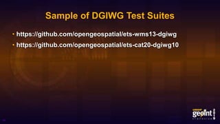
- 43. Sample of DGIWG Test Suites • https://github.com/opengeospatial/ets-wms13-dgiwg • https://github.com/opengeospatial/ets-cat20-dgiwg10 43
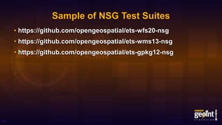
- 44. Sample of NSG Test Suites • https://github.com/opengeospatial/ets-wfs20-nsg • https://github.com/opengeospatial/ets-wms13-nsg • https://github.com/opengeospatial/ets-gpkg12-nsg 44
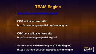
- 45. TEAM Engine • http://cite.opengeospatial.org/te2/ • OGC validation web site: • http://cite.opengeospatial.org/teamengine/ • OGC beta validation web site • http://cite.opengeospatial.org/te2 • Source code validator engine (TEAM Engine) • https://github.com/opengeospatial/teamengine 45
- 46. Using a local Docker container for OGC compliance testing • https://github.com/opengeospatial/teamengine-docker 46
- 47. Finding software implementations that are compliant to OGC standards • OGC Compliance Badge 47
- 48. List of Certified and Implementing Products 48
- 49. OGC e-Learning http://www.opengeospatial.org/learning • Web Map Service (WMS) learning objectives: – Describe how web clients and servers interact – Describe what can be done with WMS – Understand the main operations of WMS – Understand how to issue a GetMap request – Demonstrate how to configure an example WMS server • OGC Geospatial Architect – Level 1 learning objectives – Familiarization with a variety of OGC web services – Familiarization with a selection of OGC data encoding standards – Understand how to query a selection of OGC web services – Demonstrate how to interact with an OGC web service • Registration fee $99 USD