Open Source Mapping with Python, and MongoDB
0 likes69 views

The document details the design and implementation of a geospatial mapping web application using Python, Flask, and MongoDB. It discusses how to visualize geospatial data, utilize geospatial indexes, and perform complex queries to facilitate tasks like proximity searches and routing. The project showcases the integration of libraries such as Leaflet.js for interactive mapping and the setup of a REST API to serve data from a MongoDB database.

![Examples of Geospatial Data
Latitude and longitude coordinates.
Locations of restaurants, landmarks,
and cities.
Routes or paths (e.g., hiking trails,
bus routes).
Satellite imagery and geographic
boundaries (like country borders).
geo_database> db.places.find()
[
{
_id: ObjectId('66fbd265fa70425c15b81b11'),
name: 'Statue of Liberty',
location: { type: 'Point', coordinates: [ -
74.0445, 40.6892 ] }
},
{
_id: ObjectId('66fbd265fa70425c15b81b12'),
name: 'Eiffel Tower',
location: { type: 'Point', coordinates:
[ 2.294481, 48.85837 ] }
}
]](https://image.slidesharecdn.com/geospatialmappingwithpythonandmongodb-241008083831-0aee7c18/85/Open-Source-Mapping-with-Python-and-MongoDB-6-320.jpg)


![Querying Data with Geospatial Index
$near: Finds documents closest to a
given point.
$geoWithin: Finds documents within
a specified geometry.
$geoIntersects: Finds documents
that intersect a specified geometry.
Example of querying for nearby locations:
places_nearby = collection.find({
"location": {
"$near": {
"$geometry": {
"type": "Point",
"coordinates": [longitude,
latitude]
},
"$maxDistance": 5000 # Distance
in meters
}
}
})](https://image.slidesharecdn.com/geospatialmappingwithpythonandmongodb-241008083831-0aee7c18/85/Open-Source-Mapping-with-Python-and-MongoDB-12-320.jpg)


![Building the Flask API
from flask import Flask, jsonify,
make_response
from pymongo import MongoClient
from flask_cors import CORS
app = Flask(__name__)
CORS(app)
client =
MongoClient("mongodb://localhost:27017/")
db = client["geo_database"]
collection = db["places"]
Explanation:
Initializes Flask app and enables
CORS.
Connects to MongoDB using
PyMongo and targets a database
and collection.](https://image.slidesharecdn.com/geospatialmappingwithpythonandmongodb-241008083831-0aee7c18/85/Open-Source-Mapping-with-Python-and-MongoDB-17-320.jpg)
![Endpoint to retrieve nearby places based on user's current location
@app.route('/places', methods=['GET'])
def get_nearby_places():
# Get user's location from query parameters
latitude = float(request.args.get('lat'))
longitude = float(request.args.get('lng'))
Creating API Endpoint to Fetch Places](https://image.slidesharecdn.com/geospatialmappingwithpythonandmongodb-241008083831-0aee7c18/85/Open-Source-Mapping-with-Python-and-MongoDB-18-320.jpg)
![Geospatial query to find places near the given coordinates:
places = collection.find({
"location": {
"$near": {
"$geometry": {
"type": "Point",
"coordinates": [longitude, latitude]
},
"$maxDistance": 5000 # Limit to 5 kilometers
}
}
})
output = []
for place in places:
output.append({
'name': place['name'],
'location': place['location']
})
return jsonify(output)
Creating API Endpoint to Fetch Places](https://image.slidesharecdn.com/geospatialmappingwithpythonandmongodb-241008083831-0aee7c18/85/Open-Source-Mapping-with-Python-and-MongoDB-19-320.jpg)


![Fetching Data and Displaying on the Map
<script>
var map = L.map('map').setView([0, 0], 2);
L.tileLayer('https://{s}.tile.openstreetmap.org/{z}/{x}/{y}.png',
{
attribution: '© OpenStreetMap contributors'
}).addTo(map);
$.get('http://localhost:5000/places', function (data) {
data.forEach(function (place) {
var coords = place.location.coordinates;
var lat = coords[1], lng = coords[0];
var marker = L.marker([lat, lng]).addTo(map);
marker.bindPopup(place.name);
});
});
</script>
Explanation:
Initializes Leaflet map centered
at [0, 0] with zoom level 2.
Uses JQuery to fetch data from
Flask API and plot locations as
markers on the map.](https://image.slidesharecdn.com/geospatialmappingwithpythonandmongodb-241008083831-0aee7c18/85/Open-Source-Mapping-with-Python-and-MongoDB-24-320.jpg)

Open Source Mapping with Python, and MongoDB
- 1. Samuel Folasayo Geospatial Mapping with Python, and MongoDB Building a Web Application Visualize MongoDB Geospatial Data Joe Nyirenda
- 2. Geospatial Data in MongoDB GeoJSON Data about location Cartesian - small distances 2d sphere - larger distances Define shapes, points, lines Can be (x,y) coordinates or latitude /longitude Use cases Location-based services Mapping and visualization Proximity search Real-time tracking
- 3. MongoDB supports geospatial indexing for storing and querying location data. Geospatial indexes efficiently query documents based on their geographical location. Two main types: 2dsphere and 2d indexes. MongoDB Geospatial Features
- 4. Real-world Applications: Mapping (Google Maps, Uber). Proximity Search (finding nearby stores/services). Routing (shortest path between locations). MongoDB Advantages: Efficiently stores and queries geospatial data. Highly scalable and flexible for managing large datasets. Benefits of Using Geospatial Data
- 5. Urban Planning Environmental Monitoring Business Intelligence Disaster Management Use Cases of Geospatial Data
- 6. Examples of Geospatial Data Latitude and longitude coordinates. Locations of restaurants, landmarks, and cities. Routes or paths (e.g., hiking trails, bus routes). Satellite imagery and geographic boundaries (like country borders). geo_database> db.places.find() [ { _id: ObjectId('66fbd265fa70425c15b81b11'), name: 'Statue of Liberty', location: { type: 'Point', coordinates: [ - 74.0445, 40.6892 ] } }, { _id: ObjectId('66fbd265fa70425c15b81b12'), name: 'Eiffel Tower', location: { type: 'Point', coordinates: [ 2.294481, 48.85837 ] } } ]
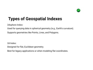
- 7. 2dsphere Index: Used for querying data in spherical geometry (e.g., Earth’s curvature). Supports geometries like Points, Lines, and Polygons. 2d Index: Designed for flat, Euclidean geometry. Best for legacy applications or when modeling flat coordinates. Types of Geospatial Indexes
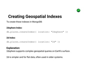
- 8. To create these indexes in MongoDB: 2dsphere Index: db.places.createIndex({ location: "2dsphere" }) 2d Index: db.places.createIndex({ location: "2d" }) Explanation: 2dsphere supports complex geospatial queries on Earth’s surface. 2d is simpler and for flat data, often used in older systems. Creating Geospatial Indexes
- 9. 2dsphere Index: Use when dealing with spherical data (e.g., latitude and longitude for Earth). 2d Index: Use for flat, Cartesian data, or when spherical accuracy is not required. When to Use 2dsphere and 2d Index
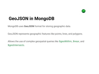
- 10. MongoDB uses GeoJSON format for storing geographic data. GeoJSON represents geographic features like points, lines, and polygons. Allows the use of complex geospatial queries like $geoWithin, $near, and $geoIntersects. GeoJSON in MongoDB
- 11. Create a 2dsphere index on the location field in MongoDB. Perform queries like $near, $geoWithin, or $geoIntersects to retrieve data based on location proximity or geographical boundaries. How to Use Geospatial Index in MongoDB
- 12. Querying Data with Geospatial Index $near: Finds documents closest to a given point. $geoWithin: Finds documents within a specified geometry. $geoIntersects: Finds documents that intersect a specified geometry. Example of querying for nearby locations: places_nearby = collection.find({ "location": { "$near": { "$geometry": { "type": "Point", "coordinates": [longitude, latitude] }, "$maxDistance": 5000 # Distance in meters } } })
- 13. Efficient querying for proximity and location-based searches. Supports complex geospatial queries with GeoJSON format. Scalable and flexible for large datasets. Benefits of Using Geo-Spatial Indexing in MongoDB
- 14. This project involves building a geospatial mapping application using Flask as the backend. It retrieves geospatial data from a MongoDB database and displays it on an interactive map with Leaflet.js. This application allows users to visualize geographical data and perform tasks like proximity searches and routing. Project Overview
- 15. Flask: Web framework for Python, easy to use for building web APIs. MongoClient (from PyMongo): Python client for MongoDB to interact with the database. Flask-CORS: Handles Cross-Origin Resource Sharing (CORS) to allow requests from different domains. Leaflet.js: JavaScript library for creating interactive maps. JQuery: JavaScript library to simplify HTTP requests and DOM manipulation. Libraries and Tools Overview
- 16. Setting Up a Python Virtual Environment Create a virtual environment: python -m .venv venv Activate the virtual environment: On Windows: .venvScriptsactivate On Mac/Linux: source .venv/bin/activate Install required libraries: pip install Flask pymongo flask-cors
- 17. Building the Flask API from flask import Flask, jsonify, make_response from pymongo import MongoClient from flask_cors import CORS app = Flask(__name__) CORS(app) client = MongoClient("mongodb://localhost:27017/") db = client["geo_database"] collection = db["places"] Explanation: Initializes Flask app and enables CORS. Connects to MongoDB using PyMongo and targets a database and collection.
- 18. Endpoint to retrieve nearby places based on user's current location @app.route('/places', methods=['GET']) def get_nearby_places(): # Get user's location from query parameters latitude = float(request.args.get('lat')) longitude = float(request.args.get('lng')) Creating API Endpoint to Fetch Places
- 19. Geospatial query to find places near the given coordinates: places = collection.find({ "location": { "$near": { "$geometry": { "type": "Point", "coordinates": [longitude, latitude] }, "$maxDistance": 5000 # Limit to 5 kilometers } } }) output = [] for place in places: output.append({ 'name': place['name'], 'location': place['location'] }) return jsonify(output) Creating API Endpoint to Fetch Places
- 20. Lightweight and Simple: Flask is a lightweight framework, perfect for small-scale applications like this. Flexible: Flask allows easy extension with additional libraries (like Flask-CORS). REST API Capabilities: Flask is well-suited for creating RESTful endpoints that can be consumed by front-end applications. Ease of Use: Minimal setup compared to more complex frameworks like Django. Why Flask for This Project?
- 21. Save the code as app.py Start the Flask server by running: python app.py Flask will run the app on http://localhost:5000 Running the Flask Server
- 22. Setting Up the Frontend with Leaflet.js <!DOCTYPE html> <html lang="en"> <head> <title>Geo Spatial Mapping with MongoDB and Python</title> <link rel="stylesheet" href="https://unpkg.com/leaflet@1.7.1/dist/lea flet.css" /> </head> <body> <div id="map" style="height: 600px;"></div> <script src="https://unpkg.com/leaflet@1.7.1/dist/leaf let.js"></script> <script src="https://code.jquery.com/jquery- 3.6.0.min.js"></script> Explanation: Includes Leaflet.js and JQuery libraries to handle map rendering and HTTP requests. Creates a div for the map display with a height of 600px.
- 23. Leaflet.js lightweight JavaScript library Designed for interactive maps Geospatial data visualization. Benefits: User-Friendly Interactivity Integration Mapping with Leaflet.js
- 24. Fetching Data and Displaying on the Map <script> var map = L.map('map').setView([0, 0], 2); L.tileLayer('https://{s}.tile.openstreetmap.org/{z}/{x}/{y}.png', { attribution: '© OpenStreetMap contributors' }).addTo(map); $.get('http://localhost:5000/places', function (data) { data.forEach(function (place) { var coords = place.location.coordinates; var lat = coords[1], lng = coords[0]; var marker = L.marker([lat, lng]).addTo(map); marker.bindPopup(place.name); }); }); </script> Explanation: Initializes Leaflet map centered at [0, 0] with zoom level 2. Uses JQuery to fetch data from Flask API and plot locations as markers on the map.
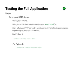
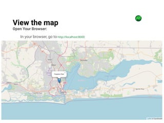
- 25. Steps: Run a Local HTTP Server: Open your terminal. Navigate to the directory containing your index.html file. Start a Python HTTP server by running one of the following commands, depending on your Python version: For Python 3: python3 -m http.server 8000 For Python 2: python -m SimpleHTTPServer 8000 Testing the Full Application
- 26. Open Your Browser: In your browser, go to http://localhost:8000 View the map
- 27. Conclusion MongoDB supports powerful geospatial queries through GeoJSON and the 2dsphere index. Applications can efficiently filter and retrieve location-based data. Geo-spatial data is crucial for real-world applications like mapping, disaster management, and proximity-based services.
Editor's Notes
- #2: Location-Based Insights: Aids in decision-making for businesses, urban planning, and environmental studies. Mapping & Visualization: Helps visualize patterns and optimize routes for supply chains and deliveries. Proximity Search: Powers apps like food delivery and ride-sharing by locating nearby services. Efficient Queries: Geospatial databases (e.g., MongoDB) improve performance for location-based searches. Real-Time Tracking: Supports tracking vehicles, aircraft, and ships for logistics and navigation.
- #7: The 2dsphere index is optimized for storing latitude/longitude data and for performing queries such as distance, intersection, or containment on spherical objects. This is the most common geospatial index in modern web applications. The 2d index is an older format, typically used for flat geometries. It's simpler but lacks spherical accuracy, making it less useful for most modern applications.
- #9: The 2dsphere index is ideal for most modern applications dealing with real-world geographic data, as it can handle the complexities of Earth's curvature. The 2d index is simpler but lacks spherical calculations, so it's rarely used in modern applications.
- #10: GeoJSON is a standard for encoding a variety of geographic data structures like points, lines, and polygons. This format is widely supported by MongoDB's geospatial indexing, particularly with the 2dsphere index. Queries with GeoJSON allow MongoDB to efficiently store, retrieve, and query spatial information.
- #11: You need to add a 2dsphere index to your collection to perform geospatial queries. For example, to find locations within a specific distance or that intersect with a geographic boundary. # Create a 2dsphere index in MongoDB db.places.create_index([("location", "2dsphere")])
- #12: The $near operator returns documents that are closest to a specified location, ideal for proximity searches (like finding nearby restaurants). The $geoWithin operator finds documents that are within a specified shape (e.g., a polygon, representing a city boundary). The $geoIntersects operator finds documents that intersect with a given shape.
- #13: The 2dsphere index is ideal for most modern applications dealing with real-world geographic data, as it can handle the complexities of Earth's curvature. The 2d index is simpler but lacks spherical calculations, so it's rarely used in modern applications.
- #15: Tools Overview: Flask: Purpose: A web framework for Python, easy to use for building web APIs. Use: Facilitates the development of server-side applications, handling requests and responses. MongoClient (from PyMongo): Purpose: Python client for MongoDB to interact with the database. Use: Allows the application to connect to and perform operations on the MongoDB database. Flask-CORS: Purpose: Handles Cross-Origin Resource Sharing (CORS) to allow requests from different domains. Use: Ensures that the application can communicate with other domains without security issues. Leaflet.js: Purpose: JavaScript library for creating interactive maps. Use: Provides a framework for displaying geospatial data visually and interactively on web pages. JQuery: Purpose: JavaScript library to simplify HTTP requests and DOM manipulation. Use: Enhances the user experience by making it easier to interact with the web page and manage data.
- #23: Benefits: User-Friendly: Simplifies the process of adding maps to web applications without needing extensive programming knowledge. Interactivity: Provides a responsive and interactive mapping experience, allowing users to zoom, pan, and click on map features for more information. Integration: Easily integrates with various data sources, including MongoDB, to dynamically display geospatial data.