SlideShare a Scribd company logo
GPUs, Clouds and Grids: Distributed Geoprocessing for Speed, Scalability and Better Living Robert Cheetham 17 February 2011 NC GIS 2011
About Azavea Founded in 2000 27 people software engineers spatial analysts project managers Web & Mobile apps Spatial Analysis R&D High Performance Computing User Experience
B Corporation 10% Research Program Pro Bono Program Time-to-Give-Back Program Employee-focused Culture  Projects with Social Value
High Performance Geoprocessing
Classic GIS Use Case ...
Close to Center City   Walk to Grocery Store   Nearby Restaurants   Library   Near a Park   Biking / walking distance from our work   Biking distance to fencing club   somewhat important vital very important nice to have somewhat important  very important somewhat important Robert’s Rules of Housing
Child Care Local School Rankings Farmer's Market PhillyCarShare Public Transit Your Factors might include…
Tax Incentives Commercial Corridor Health Public Transit Car Share Open Space Farmers’ Markets Street Network Density Recycling Participation Walkability Sustainability Factors
Not a new idea… Ian McHarg
Not a new idea … Design with Nature
Not a new idea … Map Algebra
Desktop GIS
x 5 x 2 x 3 x 1 + + + = Generate Output Heat Map
The Web is different from the Desktop Lots of simultaneous users Stateless environment HTML+JS+CSS Users are less skilled Users are less patient
ArcGIS Server Flex, Silverlight and JS API’s Publish tasks and models Caching Optimized MSD files
But wait … there’s a problem 10 – 60 second calculation time Multiple simultaneous users … …  that are impatient
User Interface version 1


Reports
Reports
 
Sustainable Business Network


Walkability: Walkshed.org
NYC Big Apps Submission
Specific Optimization Goals New Raster File format Distributed processing Binary messaging protocol
Optimization: File Format Simple - strip out metadata Limit data type and range 1D arrays are fast to read/write  Assume Same extent Same cell size Same pixel data type Same cell alignment Same projection Azavea Raster Grid (ARG)
Optimization: Distributed Processing Parallelizable - Local Ops and Focal Ops Support multiple Threads Cores CPU’s Machines Considered Hadoop Amazon Map Reduce Beowolf
Distributed Processing
Binary Messaging Protocol Started with XML Binary Protocol Buffer is better simpler 3 to 10 times smaller 20 to 100 times faster less ambiguous a bit easier to use programmatically Considered AMF Google Protocol Buffer
Success!! Reduced from 10-60 seconds to  <500 milliseconds
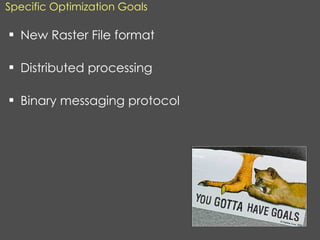
Additional [Experimental] Measures Tiling Pyramids  EC2 for planned peaks – NYC Big Apps HTTP file caching - Varnish
Optimizing one process sub-optimizes others Complex to configure and maintain One type of operation No interpolation No mixing cell sizes No mixing extents No mixing projections No Map Algebra No ModelBuilder etc.
High Performance Geoprocessing 2.0 More generic Cache data – memory is cheaper New programming technology
OMB Watch:  Federal Spending Equity
High Performance Geoprocessing 2.0 Reduced calculation time to ~40ms
GPU geoprocessing research But wait, there’s more…
GPU geoprocessing research
New languages CUDA OpenCL DirectCompute Re-write every algorithm Hardware Diversity Challenges
We re-wrote a few Map Algebra operations: Local Neighborhood Zonal Viewshed etc. 15 – 120x speed improvement Large grids Large neighborhoods Results
Not for the faint of heart
Sea Level Rise
Crime Analysis, Early Warning and Forecasting
Hunch Helper
Risk Forecasting
Animation


Food, Culture and Sustainability
Quick Demo http://commonspace.us
The Future Clouds of Processors - Google App Engine Faster is different
Summary Challenges Geographic data growth rates are exploding Size of data sets is growing Lidar Raster Social Media New form factors that are less powerful Distributed data sets Larger numbers of less technical users New Options Clouds of processors Clouds of virtual machines GPUs
Many Thanks! © Photo used with permission from  Alphafish , via  Flickr.com
GPUs, Clouds and Grids: Distributed Geoprocessing for Speed, Scalability and Better Living Robert Cheetham 17 February 2011 NC GIS 2011

More Related Content

PPT
Online Spatial Analysis for Spending Equity Mapping
PPT
From Planning to Gaming - PlanningTech@DUSP
PPT
Using GIS for Stormwater Billing and Impervious Surface Calculations
PDF
2015 GIS in Colorado: Going Mobile, Aurora Water Empowers Field Staff with Ta...
PDF
2015 FOSS4G Track: Analyzing Aspen's Community Forest with Lidar, Object-Base...
PDF
BK2015 åpningen Esri uk - dominic stubbins - the geographic renaissance
PPTX
Spatial Computing and the Future of Utility GIS
PPTX
Walking in the Cloud: A New Paradigm in Geospatial World
Online Spatial Analysis for Spending Equity Mapping
From Planning to Gaming - PlanningTech@DUSP
Using GIS for Stormwater Billing and Impervious Surface Calculations
2015 GIS in Colorado: Going Mobile, Aurora Water Empowers Field Staff with Ta...
2015 FOSS4G Track: Analyzing Aspen's Community Forest with Lidar, Object-Base...
BK2015 åpningen Esri uk - dominic stubbins - the geographic renaissance
Spatial Computing and the Future of Utility GIS
Walking in the Cloud: A New Paradigm in Geospatial World

What's hot (20)

PPTX
MODERN trends of GIS
PPSX
Capture and Use of Geo-Located Asset Information using Reality Capture Techno...
PPTX
Atmos - Tom hartley - Modelling Bird Behaviour to Progress Wind Farm Development
PPT
SEPA - Esri UK Annual Conference 2016
PPTX
Copernicus hackathon
PDF
Data‐intensive hydrologic modeling: A Cloud strategy for integrating PIHM, GI...
PPS
QSSC James Bangay
PDF
Claudio Carboni - ArcGIS platformthe foundation of your idea - Codemotion Mil...
PPTX
Surface Water - Regional Development Dorset - Pathway to a Resilient Future f...
PDF
2015 GIS Colorado Track: Migrating the City’s Intranet to Geocortex by Bruce ...
PDF
2013 Geospatial Data and Project Management Track, Mobile Big Data by Genie Hays
PDF
22 - CSIRO - Water Data Management-Sep-17
PDF
EPOP: Quantifying Violent Risk for Every Point on the Planet
PDF
TIGER/line Data and Open Data in the Cloud
PPT
TIGER/Line Data in the Cloud - Tom MacWright
PPTX
Severn Trent Water - Esri UK Annual Conference 2016
PPTX
Tb geo dev_presentation_nov_5
PDF
Prospecting for Profits with GIS
PPTX
2017 GeoIOTWorld
PPTX
UC Presentation
MODERN trends of GIS
Capture and Use of Geo-Located Asset Information using Reality Capture Techno...
Atmos - Tom hartley - Modelling Bird Behaviour to Progress Wind Farm Development
SEPA - Esri UK Annual Conference 2016
Copernicus hackathon
Data‐intensive hydrologic modeling: A Cloud strategy for integrating PIHM, GI...
QSSC James Bangay
Claudio Carboni - ArcGIS platformthe foundation of your idea - Codemotion Mil...
Surface Water - Regional Development Dorset - Pathway to a Resilient Future f...
2015 GIS Colorado Track: Migrating the City’s Intranet to Geocortex by Bruce ...
2013 Geospatial Data and Project Management Track, Mobile Big Data by Genie Hays
22 - CSIRO - Water Data Management-Sep-17
EPOP: Quantifying Violent Risk for Every Point on the Planet
TIGER/line Data and Open Data in the Cloud
TIGER/Line Data in the Cloud - Tom MacWright
Severn Trent Water - Esri UK Annual Conference 2016
Tb geo dev_presentation_nov_5
Prospecting for Profits with GIS
2017 GeoIOTWorld
UC Presentation
Ad

Viewers also liked (6)

PDF
BigData, Hadoop과 Node.js
PDF
AWS를 활용한 첫 빅데이터 프로젝트 시작하기(김일호)- AWS 웨비나 시리즈 2015
PDF
빅 데이터 분석을 위한 AWS 활용 사례 - 최정욱 솔루션즈 아키텍트:: AWS Cloud Track 1 Intro
PPTX
Node.js를 사용한 Big Data 사례연구
PDF
BigData, Hadoop과 Node.js, R2
PDF
Pull reqeust 활용기
BigData, Hadoop과 Node.js
AWS를 활용한 첫 빅데이터 프로젝트 시작하기(김일호)- AWS 웨비나 시리즈 2015
빅 데이터 분석을 위한 AWS 활용 사례 - 최정욱 솔루션즈 아키텍트:: AWS Cloud Track 1 Intro
Node.js를 사용한 Big Data 사례연구
BigData, Hadoop과 Node.js, R2
Pull reqeust 활용기
Ad

Similar to GPUs, Cloud and Grids: Distributed Geoprocessing for Speed, Scalability and Better Living (20)

PPT
Geoprocessing in Web Time (Robert Cheetham)
PPTX
Distributed computing poli
PPT
Would Mr. Spok choose Open Source
PPTX
The Six pillars for Building big data analytics ecosystems
PPTX
Big Data - An Overview
PPTX
Big Data with hadoop, Spark and BigQuery (Google cloud next Extended 2017 Kar...
PDF
Start Getting Your Feet Wet in Open Source Machine and Deep Learning
PPTX
GraphLab Conference 2014 Keynote - Carlos Guestrin
PDF
Big Data Architecture
PPT
Architecting the Future of Big Data and Search
PPTX
Unlocking Operational Intelligence from the Data Lake
PPTX
Big Data and Hadoop
PDF
High-performance database technology for rock-solid IoT solutions
PPTX
Information processing architectures
PPTX
Bigdata
PPTX
Big Data and NoSQL for Database and BI Pros
PPTX
BigData
PDF
A Survey on Big Data Analysis Techniques
PDF
Smart App@Pivotal by Dat Tran
PPT
Download It
Geoprocessing in Web Time (Robert Cheetham)
Distributed computing poli
Would Mr. Spok choose Open Source
The Six pillars for Building big data analytics ecosystems
Big Data - An Overview
Big Data with hadoop, Spark and BigQuery (Google cloud next Extended 2017 Kar...
Start Getting Your Feet Wet in Open Source Machine and Deep Learning
GraphLab Conference 2014 Keynote - Carlos Guestrin
Big Data Architecture
Architecting the Future of Big Data and Search
Unlocking Operational Intelligence from the Data Lake
Big Data and Hadoop
High-performance database technology for rock-solid IoT solutions
Information processing architectures
Bigdata
Big Data and NoSQL for Database and BI Pros
BigData
A Survey on Big Data Analysis Techniques
Smart App@Pivotal by Dat Tran
Download It

More from Azavea (20)

PPTX
Using New Tools to Analyze and Plan Your Urban Forest
PPTX
7 misconceptions about predictive policing webinar
PPTX
Tracking Your Green Infrastructure
PPTX
Growing Your Urban Forest: Using the OpenTreeMap Bulk Uploader
PDF
Forecasting Space-Time Events - Strata + Hadoop World 2015 San Jose
PPTX
November 12, 2014 Webinar: Hackers, Beer Geeks, and Arborly Love - Reaching o...
PPTX
Mobile Citizen Science
PPTX
Getting Started with OpenTreeMap Cloud
PDF
HunchLab 2.0 Getting Started
PDF
Is it a Package or a Wrapper? Designing, Documenting, and Distributing a Pyth...
PPTX
Your New Partners: Understanding Civic Hackathons, Why You Should be Involved...
PDF
HunchLab 2.0 Predictive Missions: Under the Hood
PPTX
Using Open Data and Citizen Science to Promote Citizen Engagement with Green ...
PDF
HunchLab 2.0 Preview Webinar - Place
PDF
Five Technology Trends Every Nonprofit Needs to Know
PPTX
PhillyHistory.org - Tracking Metrics for a Digital Project
PPTX
Data Philly Meetup - Big (Geo) Data
PPTX
Fed Geo Day - Applying GeoTrellis at the US Army Corps
PPTX
Fed Geo Day - GeoTrellis Intro
PPTX
Fed Geo Day 2013 - Azavea Intro
Using New Tools to Analyze and Plan Your Urban Forest
7 misconceptions about predictive policing webinar
Tracking Your Green Infrastructure
Growing Your Urban Forest: Using the OpenTreeMap Bulk Uploader
Forecasting Space-Time Events - Strata + Hadoop World 2015 San Jose
November 12, 2014 Webinar: Hackers, Beer Geeks, and Arborly Love - Reaching o...
Mobile Citizen Science
Getting Started with OpenTreeMap Cloud
HunchLab 2.0 Getting Started
Is it a Package or a Wrapper? Designing, Documenting, and Distributing a Pyth...
Your New Partners: Understanding Civic Hackathons, Why You Should be Involved...
HunchLab 2.0 Predictive Missions: Under the Hood
Using Open Data and Citizen Science to Promote Citizen Engagement with Green ...
HunchLab 2.0 Preview Webinar - Place
Five Technology Trends Every Nonprofit Needs to Know
PhillyHistory.org - Tracking Metrics for a Digital Project
Data Philly Meetup - Big (Geo) Data
Fed Geo Day - Applying GeoTrellis at the US Army Corps
Fed Geo Day - GeoTrellis Intro
Fed Geo Day 2013 - Azavea Intro

Recently uploaded (20)

PDF
Assigned Numbers - 2025 - Bluetooth® Document
PDF
Encapsulation_ Review paper, used for researhc scholars
PDF
Optimiser vos workloads AI/ML sur Amazon EC2 et AWS Graviton
PDF
Machine learning based COVID-19 study performance prediction
PPTX
A Presentation on Artificial Intelligence
PDF
Mobile App Security Testing_ A Comprehensive Guide.pdf
DOCX
The AUB Centre for AI in Media Proposal.docx
PDF
Unlocking AI with Model Context Protocol (MCP)
PDF
Chapter 3 Spatial Domain Image Processing.pdf
PDF
Blue Purple Modern Animated Computer Science Presentation.pdf.pdf
PDF
The Rise and Fall of 3GPP – Time for a Sabbatical?
PDF
Empathic Computing: Creating Shared Understanding
PPT
“AI and Expert System Decision Support & Business Intelligence Systems”
PDF
Profit Center Accounting in SAP S/4HANA, S4F28 Col11
PDF
Approach and Philosophy of On baking technology
PDF
Agricultural_Statistics_at_a_Glance_2022_0.pdf
PDF
Building Integrated photovoltaic BIPV_UPV.pdf
PDF
Network Security Unit 5.pdf for BCA BBA.
PPTX
Spectroscopy.pptx food analysis technology
PDF
Electronic commerce courselecture one. Pdf
Assigned Numbers - 2025 - Bluetooth® Document
Encapsulation_ Review paper, used for researhc scholars
Optimiser vos workloads AI/ML sur Amazon EC2 et AWS Graviton
Machine learning based COVID-19 study performance prediction
A Presentation on Artificial Intelligence
Mobile App Security Testing_ A Comprehensive Guide.pdf
The AUB Centre for AI in Media Proposal.docx
Unlocking AI with Model Context Protocol (MCP)
Chapter 3 Spatial Domain Image Processing.pdf
Blue Purple Modern Animated Computer Science Presentation.pdf.pdf
The Rise and Fall of 3GPP – Time for a Sabbatical?
Empathic Computing: Creating Shared Understanding
“AI and Expert System Decision Support & Business Intelligence Systems”
Profit Center Accounting in SAP S/4HANA, S4F28 Col11
Approach and Philosophy of On baking technology
Agricultural_Statistics_at_a_Glance_2022_0.pdf
Building Integrated photovoltaic BIPV_UPV.pdf
Network Security Unit 5.pdf for BCA BBA.
Spectroscopy.pptx food analysis technology
Electronic commerce courselecture one. Pdf

GPUs, Cloud and Grids: Distributed Geoprocessing for Speed, Scalability and Better Living

Editor's Notes

  • #6: So this story starts with my wife and I looking for a house and being frustrated by the type of information we had access to. We didn&apos;t know where to start. Each of the real estate agents we met knew a particular part of the city really well, so they tended to steer us toward those houses.
  • #7: We didn&apos;t own a car, so we wanted to find a place that was * Close to Center City (somewhat important) * Walking distance to a grocery store (vital) * Near some restaurants (very important) * Walk to a library (nice to have) * Near a Park (yes!) * Close to fencing * Biking / walking distance from our work
  • #8: The factors you consider important are probably not the same as ours. Maybe yours are related to child care or rankings for local schools or being near a farmer&apos;s market. Or maybe you want to be close to PhillyCarShare or public transit, but don&apos;t want to be too close to downtown.
  • #9: We selected a variety of factors that contribute to sustainability, ranging from location in a state or federal tax incentive zone to environmental amenities like tree canopy to transit considerations like access to bus and regional rail lines. Retail businesses targeting markets may be interested in demographic factors like age and per capita income and proxies for environmental engagement like recycling participation.
  • #10: Many of the ideas here are not new. Actually, they were developed here in Philadelphia by Ian McHarg, who was chair of the Landscape Architecture and Regional Planing department at the University of Pennsylvania
  • #11: He wrote a book in 1969 called Design with Nature, and focused on sustainable and ecological design. Among other concepts, he described how a series of inputs drawn on transparent acetate sheets. Could be combined as a set of map overlays to identify the best site for a particular facility, road or whatever.
  • #12: Now fast forward to the 1990’s. We’re interested in digital maps. This approach to compositing several digital maps was developed further by Dana Tomlin, who is now also a professor at University of Pennsylvania. Tomlin developed the computational vocabulary to perform this type of work – he called it Map Algebra. He’s also a really great teacher, so if you ever get a chance to take a class with him. Do it. He’s great.
  • #13: So, these days people do this kind of work using desktop GIS systems. You are looking at the ArcMap application from ESRI
  • #27: Export to KML
  • #29: scenarios
  • #30: Heat map
  • #59: Export to KML
  • #60: Export to KML
  • #61: Export to KML